
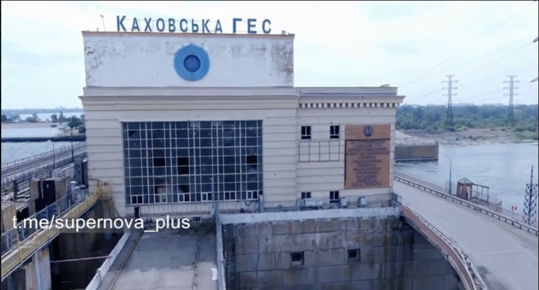
Kakhovka Dam Breach
Assembled by Kos Palchyk ↗
This is a living document,
please @ me on twitter to add something
I’m not an expert on dams
#StandWithUkraine ↗ #RussiaIsATerroristState ↗
#Preface
On February 24th, 2022 russia occupied Kakhovka dam.
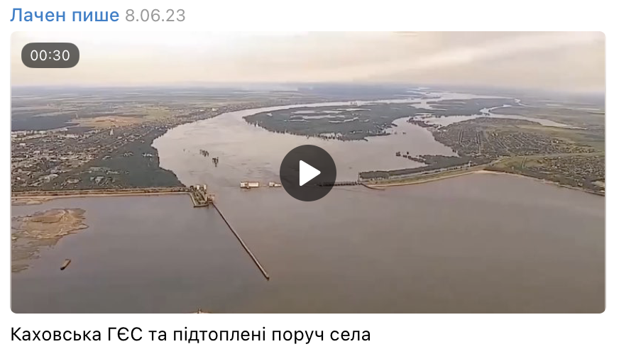
On June 6th, 2023 Kakhovka dam was breached.
#Summary
Currently widely accepted version of the dam breach is that it was blown up. In this document, I want to show that our evidence of explosion is not sufficient, while there are indications of criminal negligence of the dam for many months before the breach. Signs of possible progressing river floor scouring appeared at least 38 days before the breach, which could've led to the dam collapse on June 6th. Mismanaging critical infrastructure can be as dangerous as putting explosives on it, and there’s good evidence that the dam was unintentionally or intentionally ill-maintained during the russian occupation.
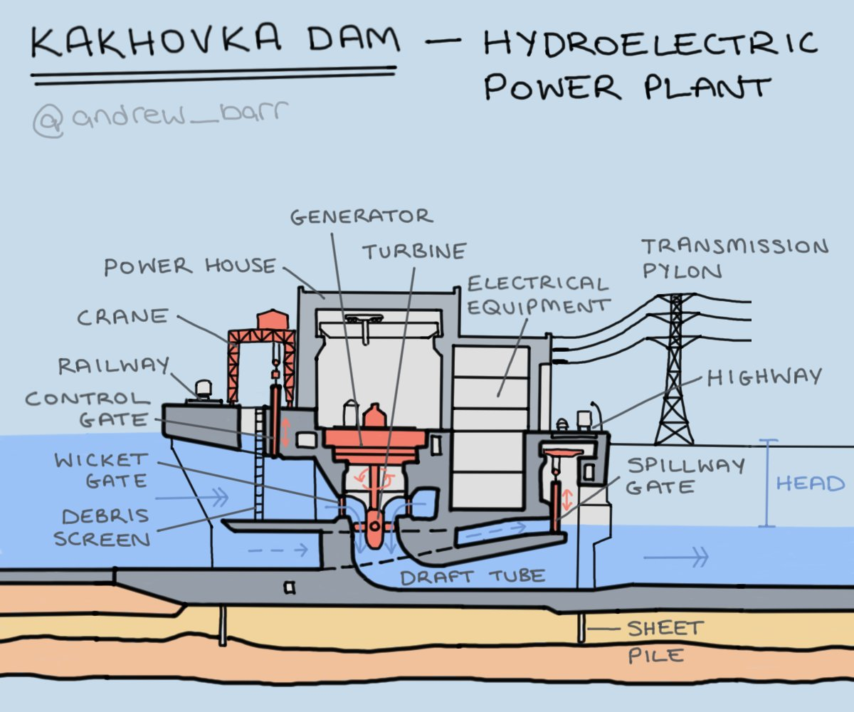
To understand what happened on June 6th, 2023 we need to understand how the dam works and what was happening at the dam before the tragedy. So let's start with the mechanics:

Illustration author: Andrew Barr ↗
Source: https://twitter.com/andrew_barr/status/1668979717989335042 ↗
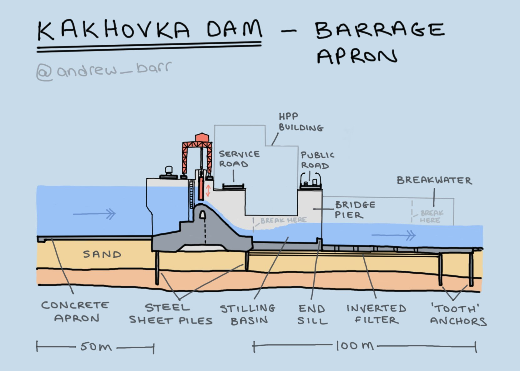
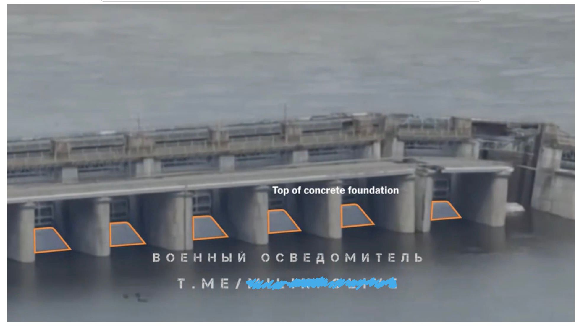
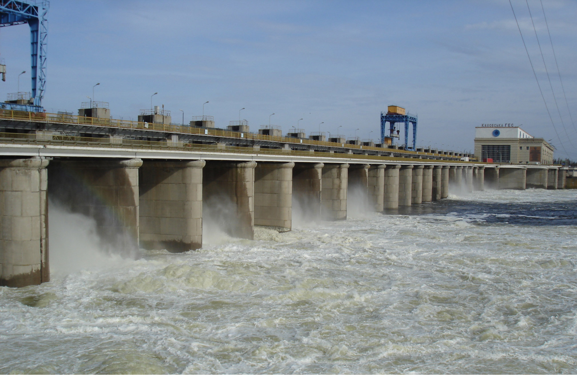
Water flows from higher levels to lower levels, from the reservoir upstream to the downstream Dnipro. The energy water carries turns turbines at the Hydro Power Plant (HPP, on the right), producing electricity. If there's excess water at the reservoir (often during Spring floods) — the water is drained through sluice gates, that stand on a gravity dam (weir). Water drained through sluice gates still carries energy, which should be dissipated safely. For that purpose, river floor protective layer downstream from the dam was built to slow down the water and protect the sandy river floor from erosion:
Kakhovka dam cross section
← upstream reservoir, barrage, downstream →
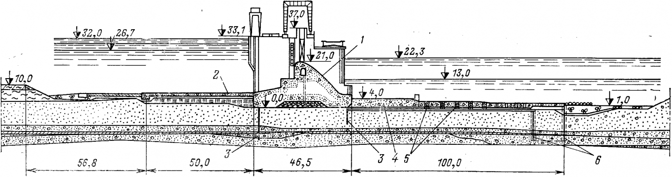
1 - gravity dam, 4 & 5 - river floor protective layers (concrete apron and rysberma)
Since russian occupation of the dam, there have been two massive drainages through the gates:
First drainage lasted at least 45 days in May-June 2022, during Spring floods:
May-June 2022
↖ right bank, barrage, HPP, Lock, left bank ↘
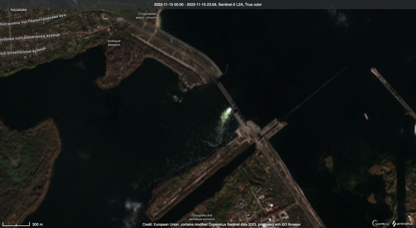
Source: https://sentinelshare.page.link/rxDu ↗
What’s left of the original HPP crew is still allowed to the dam, so they decently manage this period of Spring 2022 floods. But at around September-October the native HPP crew is no longer allowed to the dam by the occupants, and since then the dam management becomes reckless. Which leads us to the second drainage:
Second drainage was a 8 months of almost continuous drainage from October till the dam breach in June, last 7 months of which (235 days) was uninterrupted drainage through gates on just one side, near the HPP. On the same side, where the June 2023 breach will happen:
Oct 2022 - June 2023 (breach)
↖ right bank, barrage, HPP, Lock, left bank ↘
Source: https://sentinelshare.page.link/tt29 ↗
During this period the drainage happens only on one side of the river, near the HPP. There’s no symmetry in the opened gates and there’s no open-closed-open pattern of the gates, which we often see during drainages. Gates #1, #3, #5, #6, and #7 are opened together with HPP gates for 235 days straight.
For safe water drainage it's not only important to constantly account for upstream water loads, but it's crucial to also operate the sluice gates according to the maintenance manuals. Let's compare the 2022-2023 drainage case to how native crew operated the dam before the occupation:
April 2018
↖ right bank, barrage, HPP, Lock, left bank ↘

Source: https://sentinelshare.page.link/SzuZ ↗
This is an example from Spring floods of 2018, the drainage lasted for at most 18 days. Gate opening happened when HPP turbines didn’t spend enough water during the floods. In this case gate opening was done in phases, according to the existing water load from the Kakhovka water reservoir. Decision to open the sluice gates was ratified by a specialized committee and even got to the UkrHydroEnergo news: gates opening in 2018. Note that the gates were opened in a symmetrical to each other and to the HPP layout. Meaning that right-bank and left-bank gates are opened symmetrically. First 2 + HPP, then 2 + 2 + HPP, then 4 + 2 + HPP. As seen in the publications, the gate groups were opened in open-close-open pattern.
Going back to the 8-month long 2022-2023 water drainage, done by the occupants. That reckless continuous uncontrolled drainage led to critical Kakhovka reservoir water levels:
First it led to record low levels in winter time (when Dnipro has less water income), and then to record high levels during Spring floods (when rains and melting snow bring a lot of water to Dnipro). The five constantly opened gates first gave too much water in Winter, and then the same five opened gates were not enough for the Spring floods.
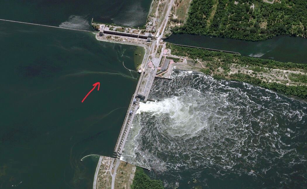
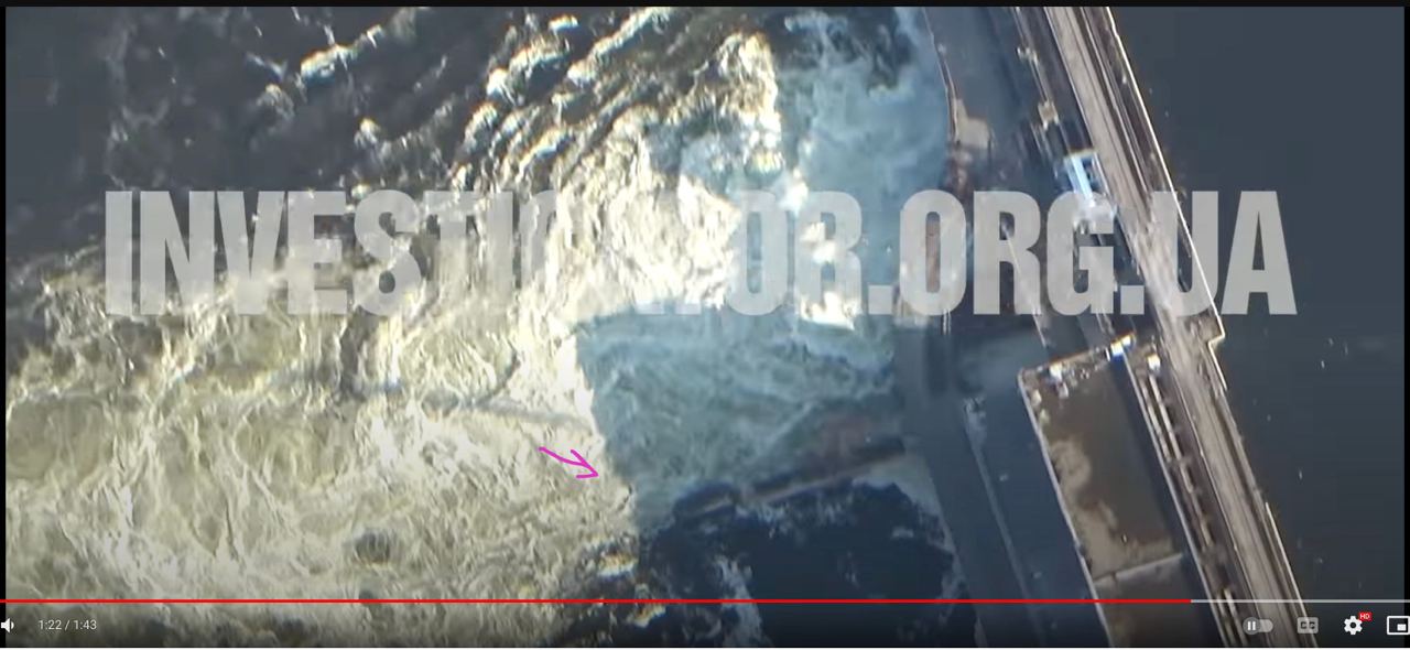
Constant drainage and big water level difference in Spring likely led to river bed scouring, first indication of which we see on 28 April 2023 — part of the wall separating HPP & dam breaks:
Source: https://youtu.be/6XNV9QfHm54?t=20 ↗
It is a ~5-meter-thick concrete wall, breaking of which was either caused by or it led to river floor protective layer damage. Which was a big deal, but nothing was done to mend the damage, or to divert the stream. The same 5 sluice gates remained open.
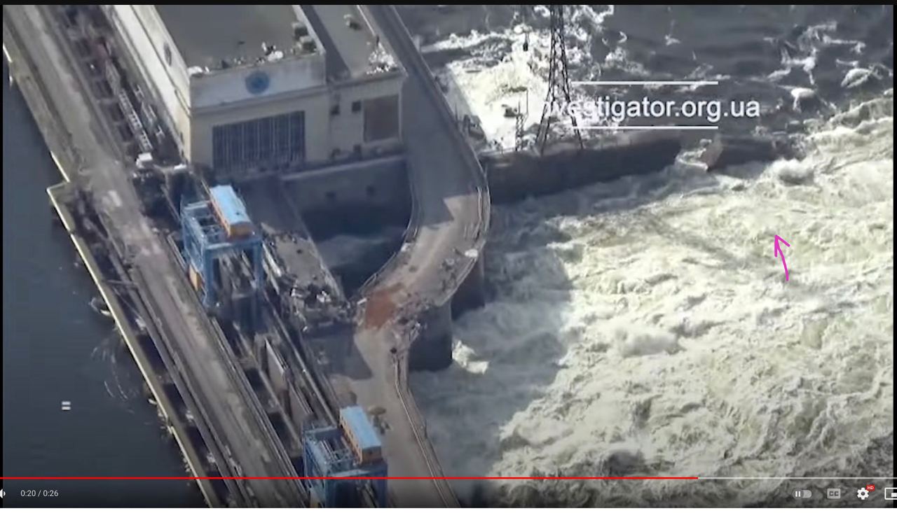
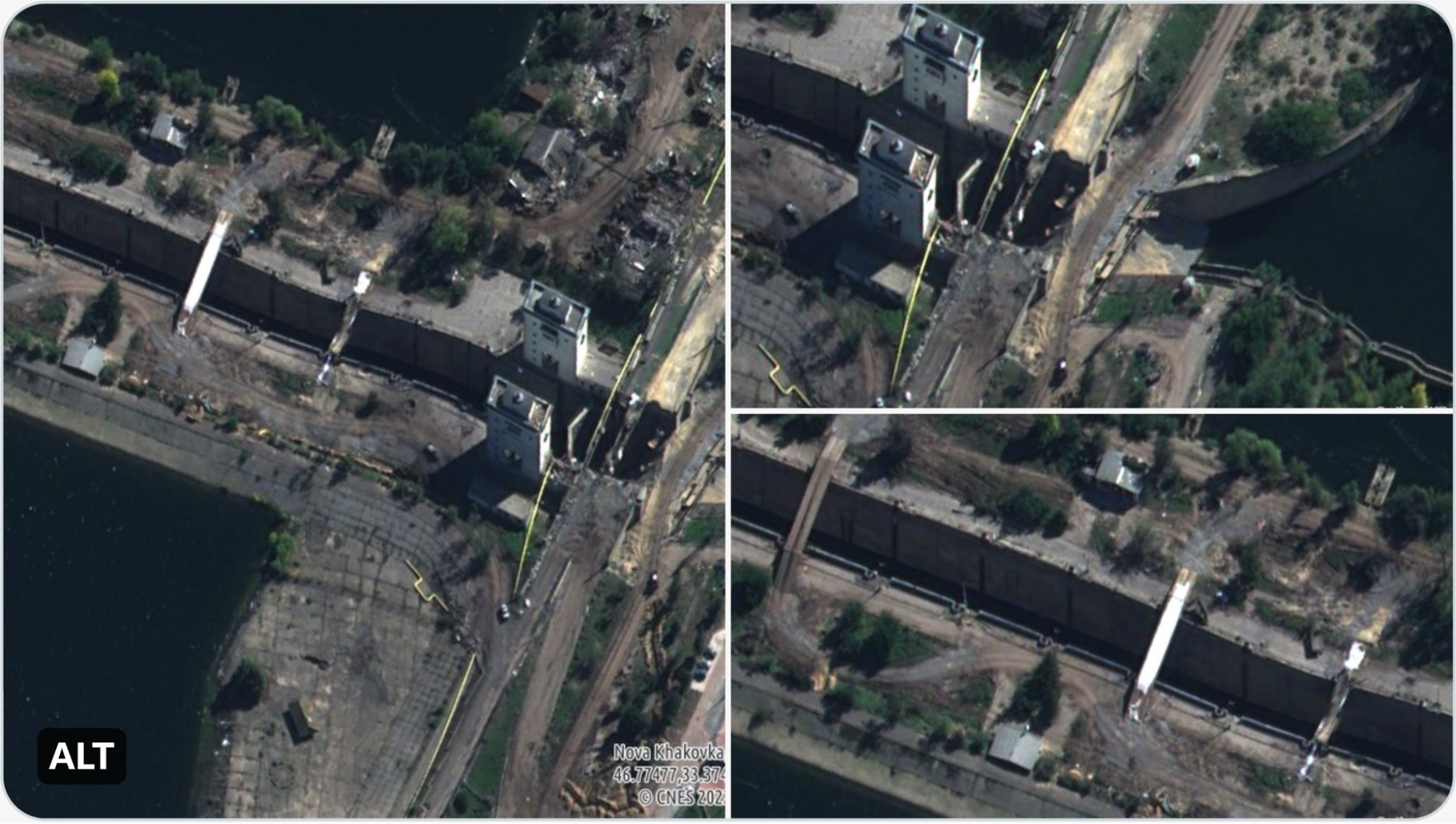
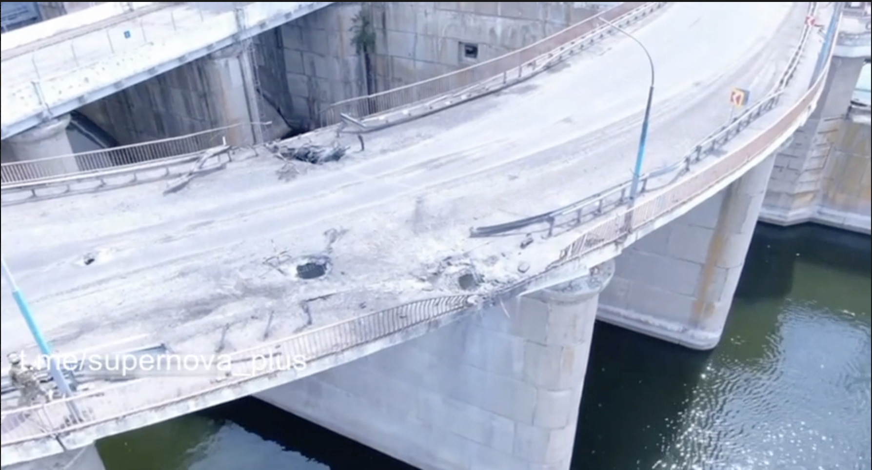
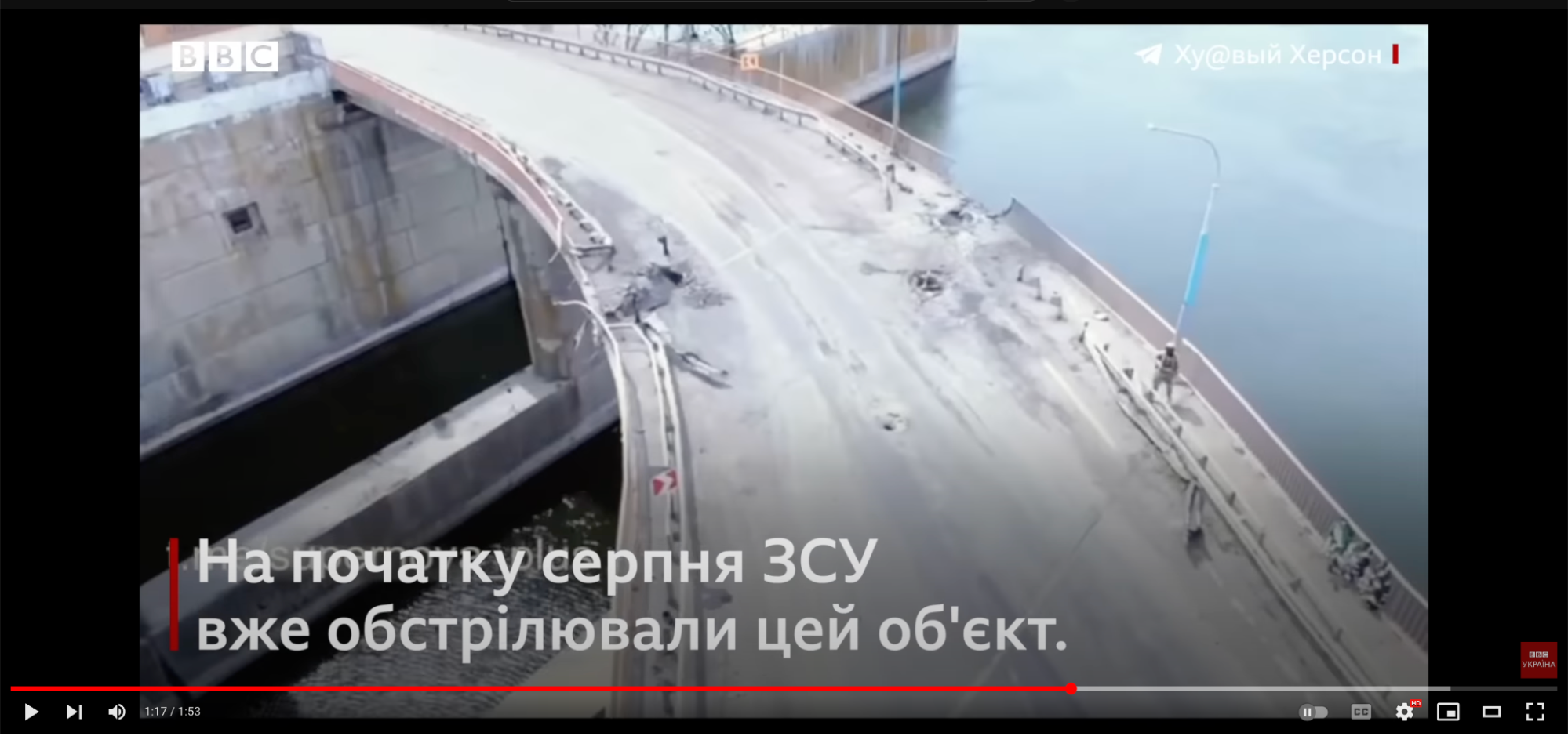
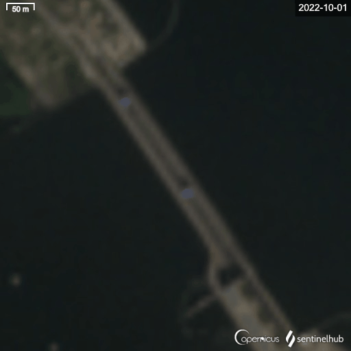
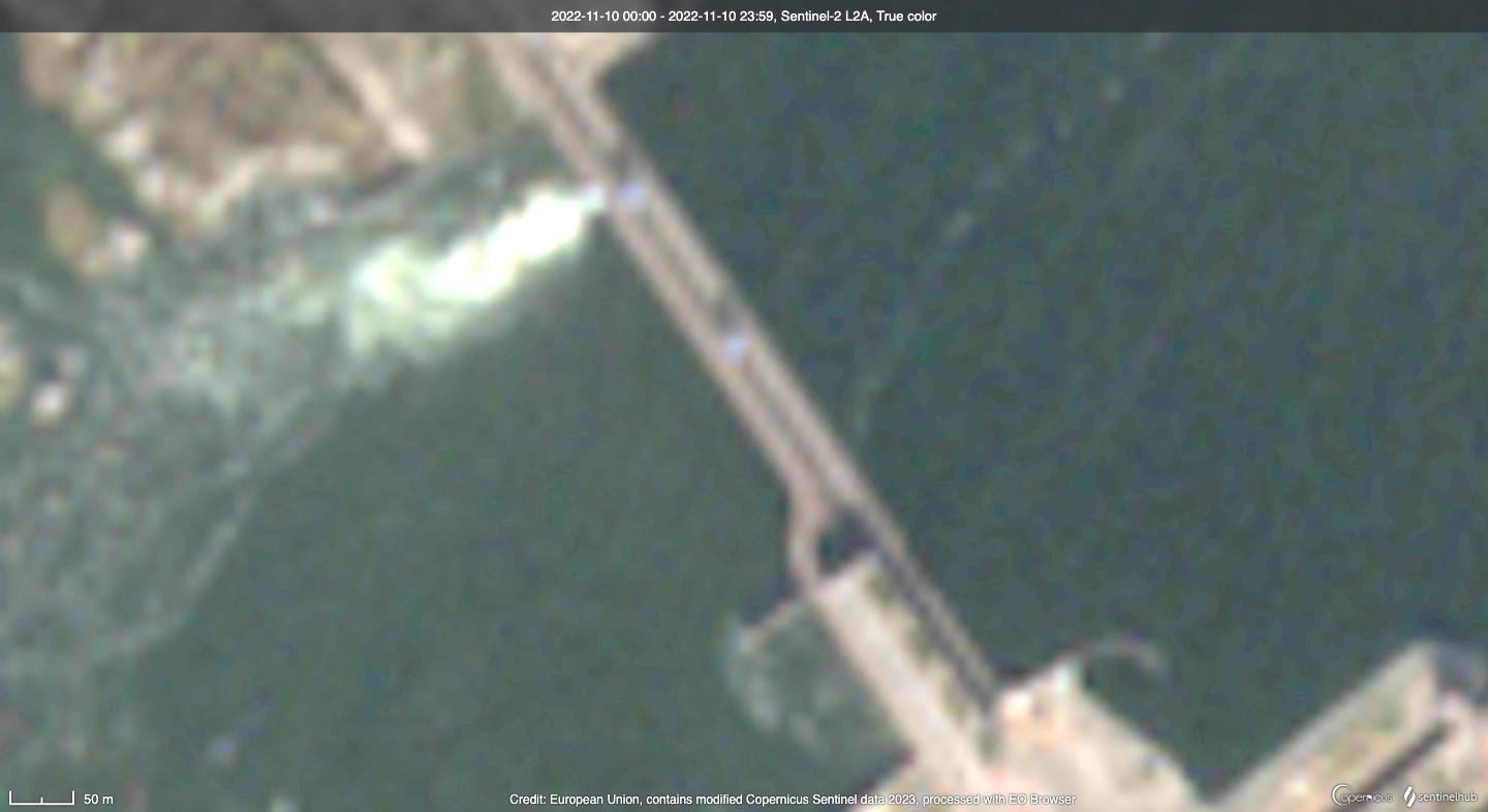
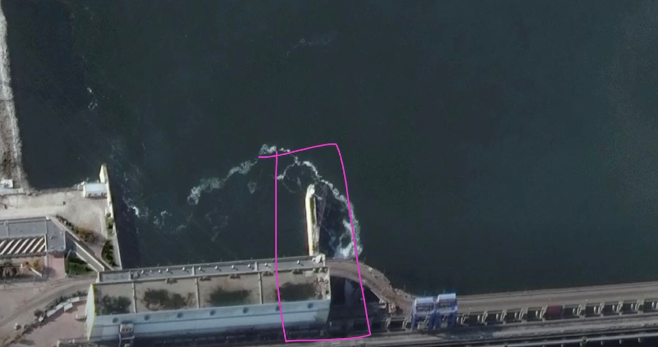
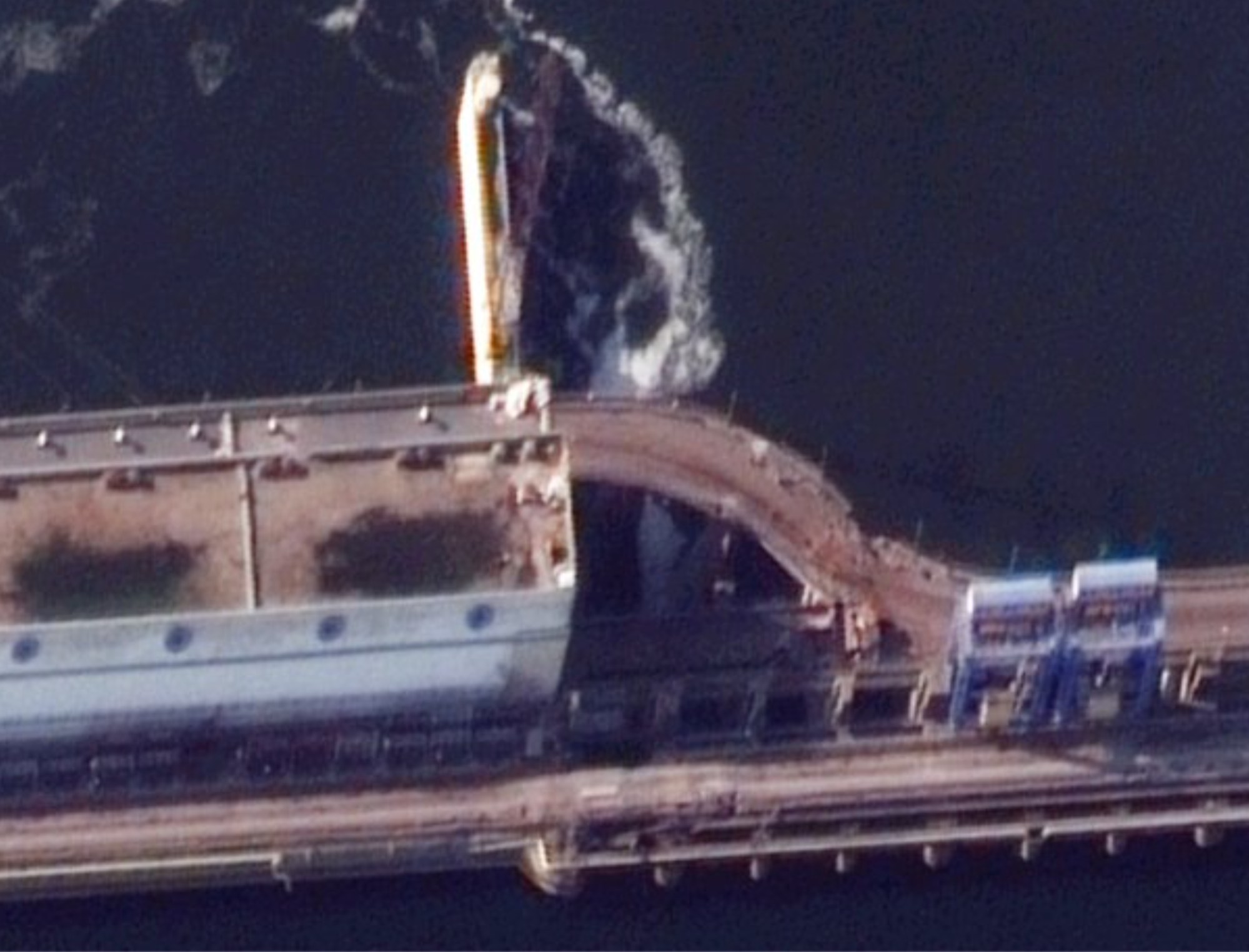
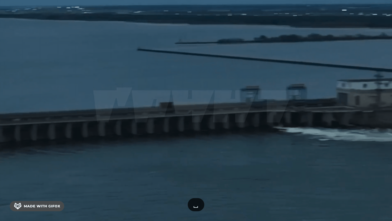
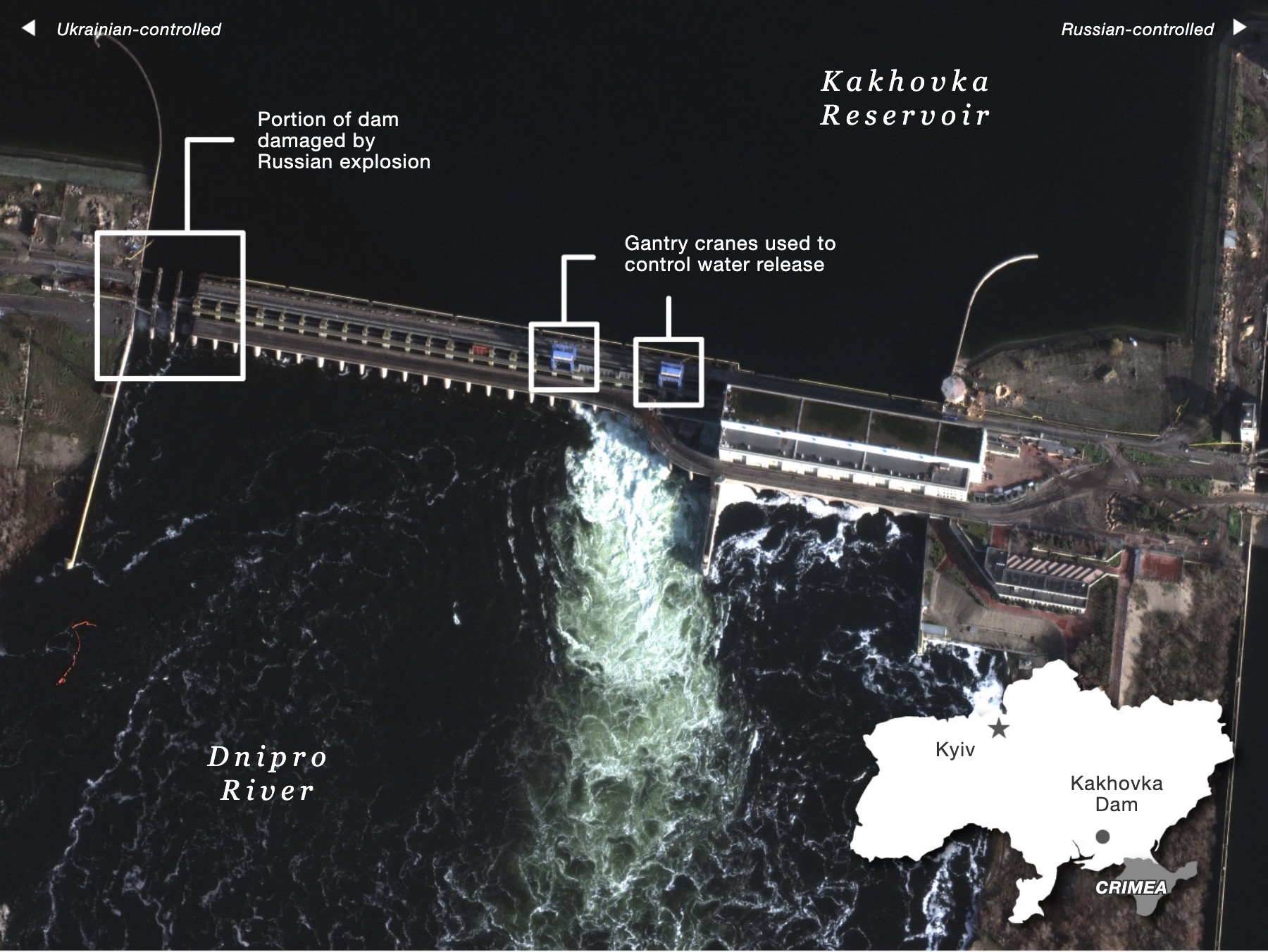
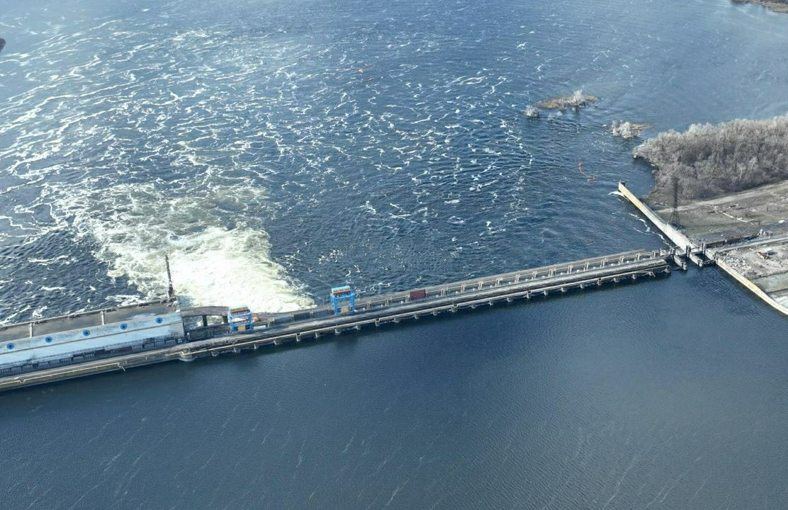
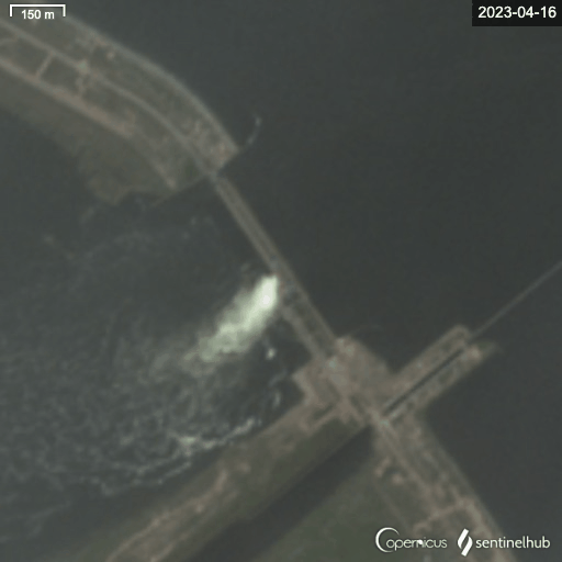
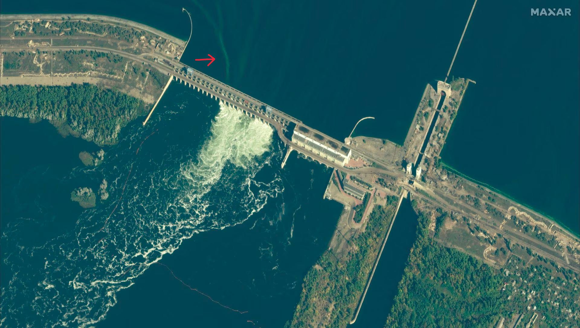
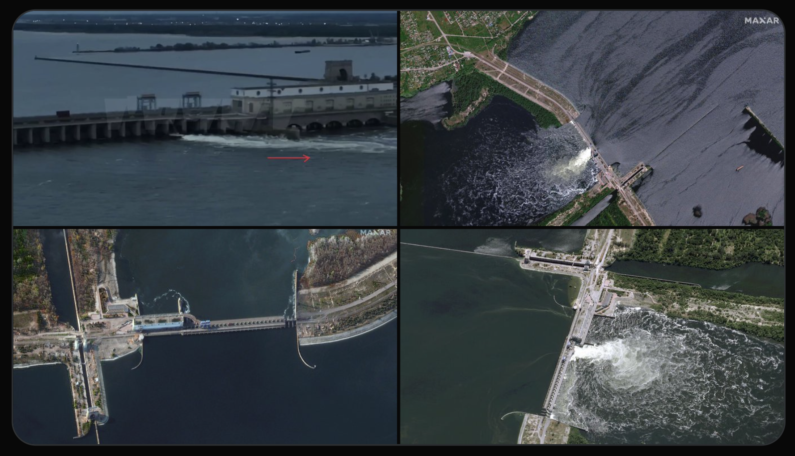
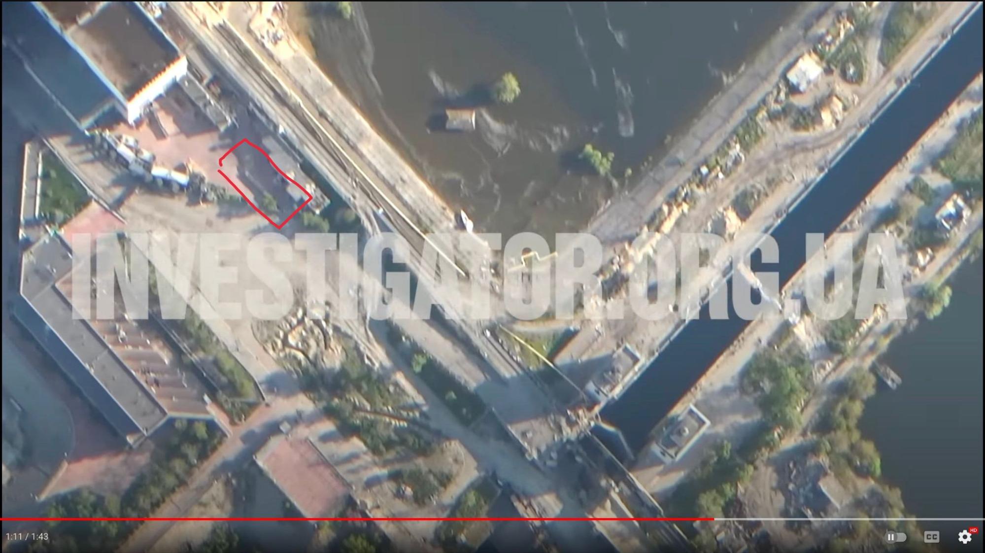
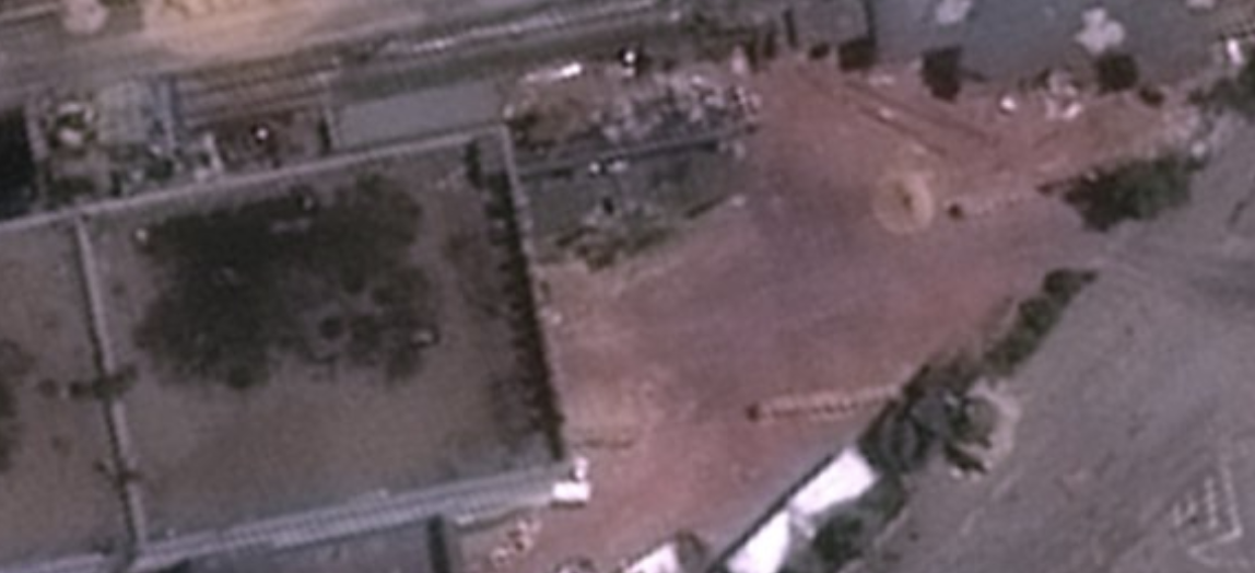
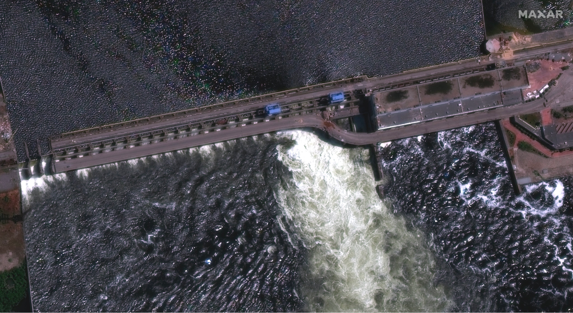
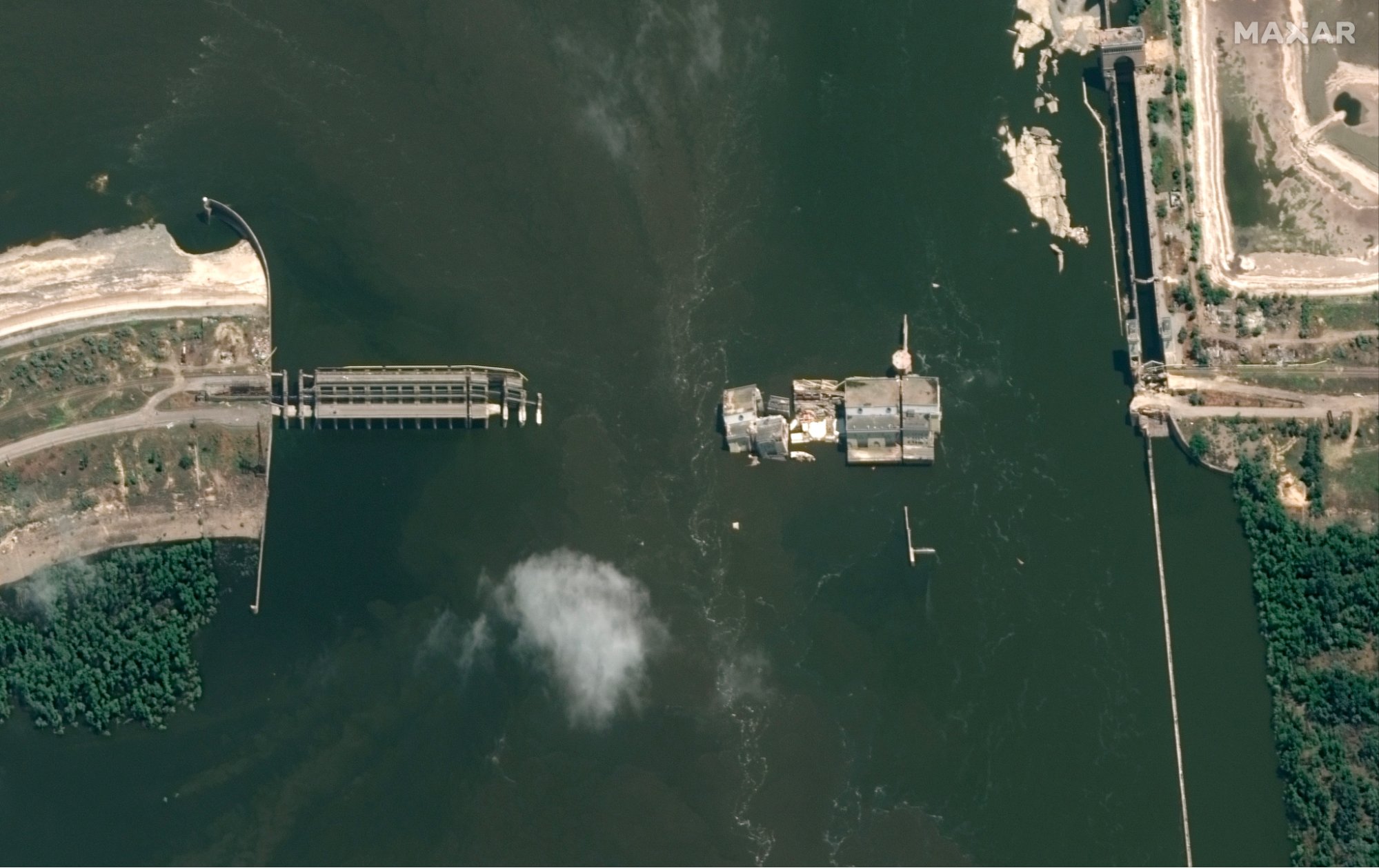
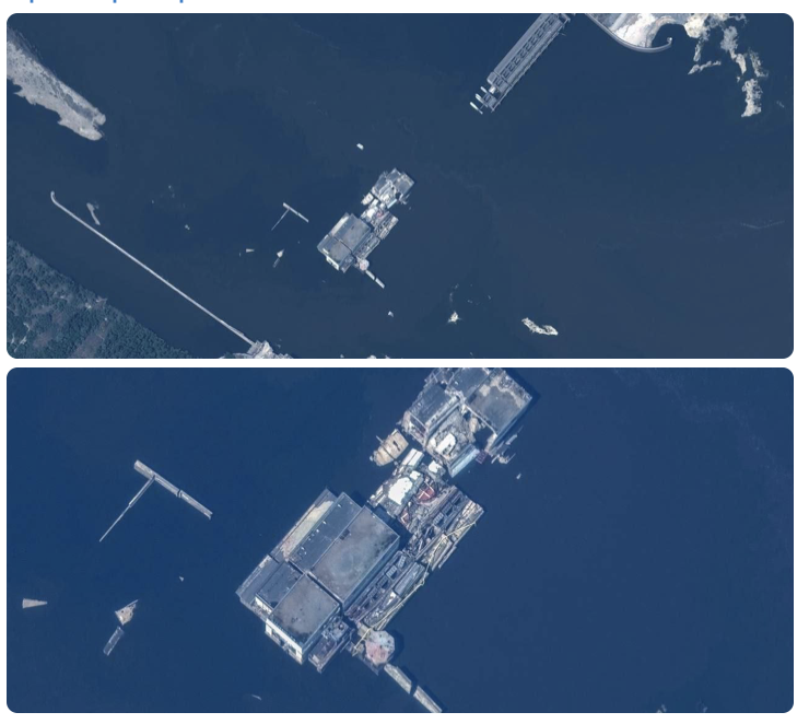
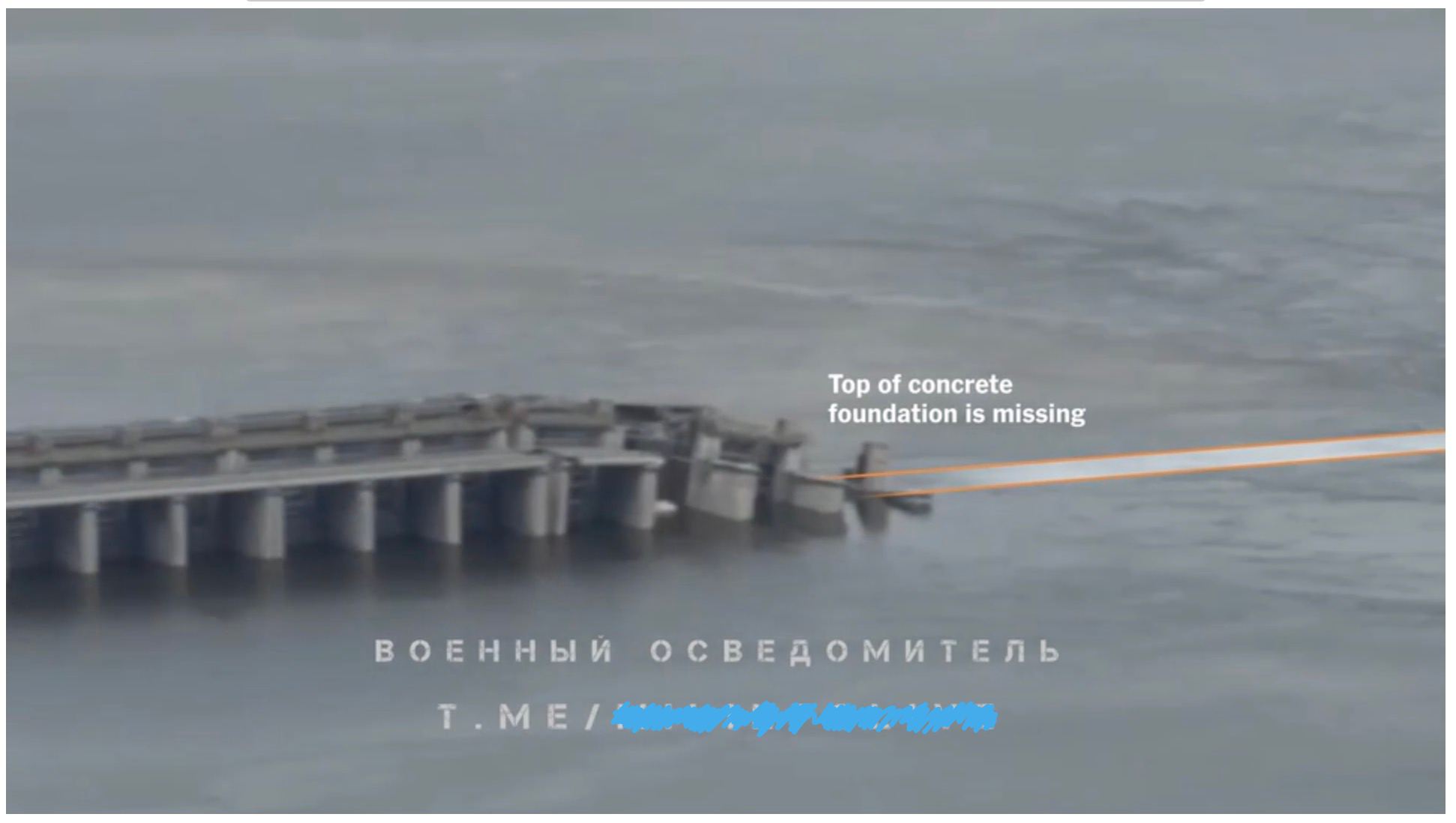
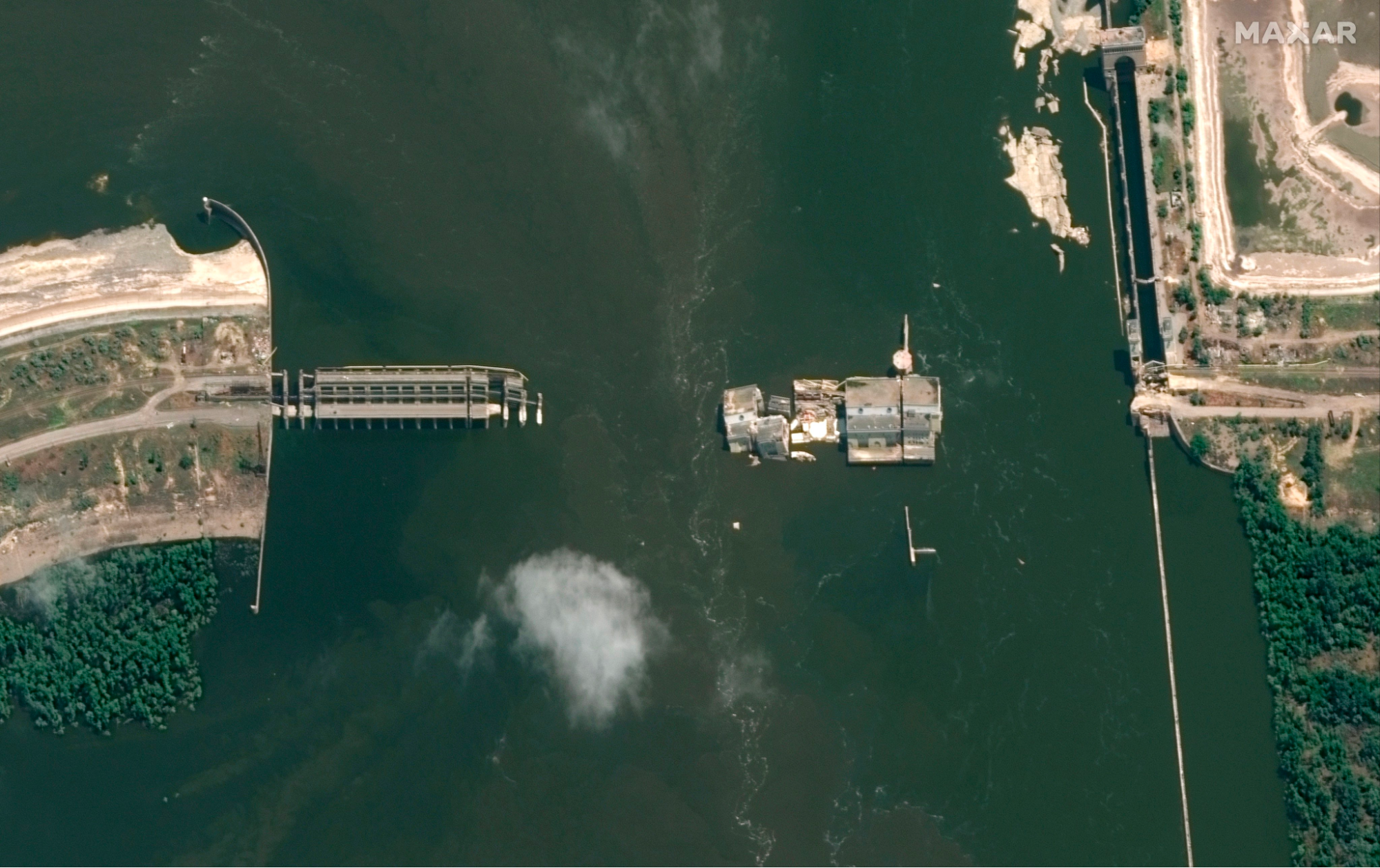
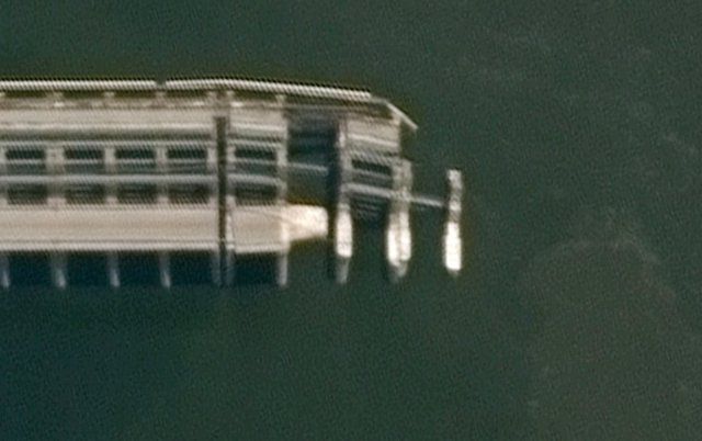
About a month later, signs of river floor scour continue with a collapse of the s-bridge early in June. From four to three days before the dam breach, the road bridge bend near the HPP collapsed, as seen in these satellite images:
Early June 2023, few days before the breach
↖ right bank, barrage, HPP, Lock, left bank ↘
River bed scouring actually already happened in similar circumstances, when the dam was under construction in the 1950's: K-Dam river bed was already scoured once. A flood occurred during the construction of the dam. This forced engineers to drain water through gates on one side of the dam, while water level downstream of the dam was 2 meters below normal. That led to river bed scouring / washout just downstream from rysberma for 9m deep (rysberma is a river floor protective layer downstream from the dam, see blueprints for more info).

Source: see blueprints
So we had river floor scouring in the 1950's, in a similar situation, some 100+ meters downstream (disclaimer: I bet it got fixed then, I reference it only as a similar case). Then we have the separator wall collapse on 28 April 2023, 38 days before the breach, some 100 meters downstream from the barrage. Then we have the bridge foundations collapse on 1-2 and 2-3 of June 2023, four to three days before the catastrophe, right at the base of the dam.
Progressing upstream river bed scouring could undermine the basis of the weir and the HPP structures. Which could cause them to collapse under their own weight and water pressure from the reservoir, leading to the dam breach on 6th of June, 2023:
Source: https://t.me/grey_zone/19067 ↗
This evidence cannot rule out possible intentional explosive demolition of the dam by russians on 06 June 2023, or accidental explosions on the dam that would speed up dam destruction. But it seems like russian mismanagement of the dam could've led to the dam breach on its own.
#What is that scouring that you keep mentioning?
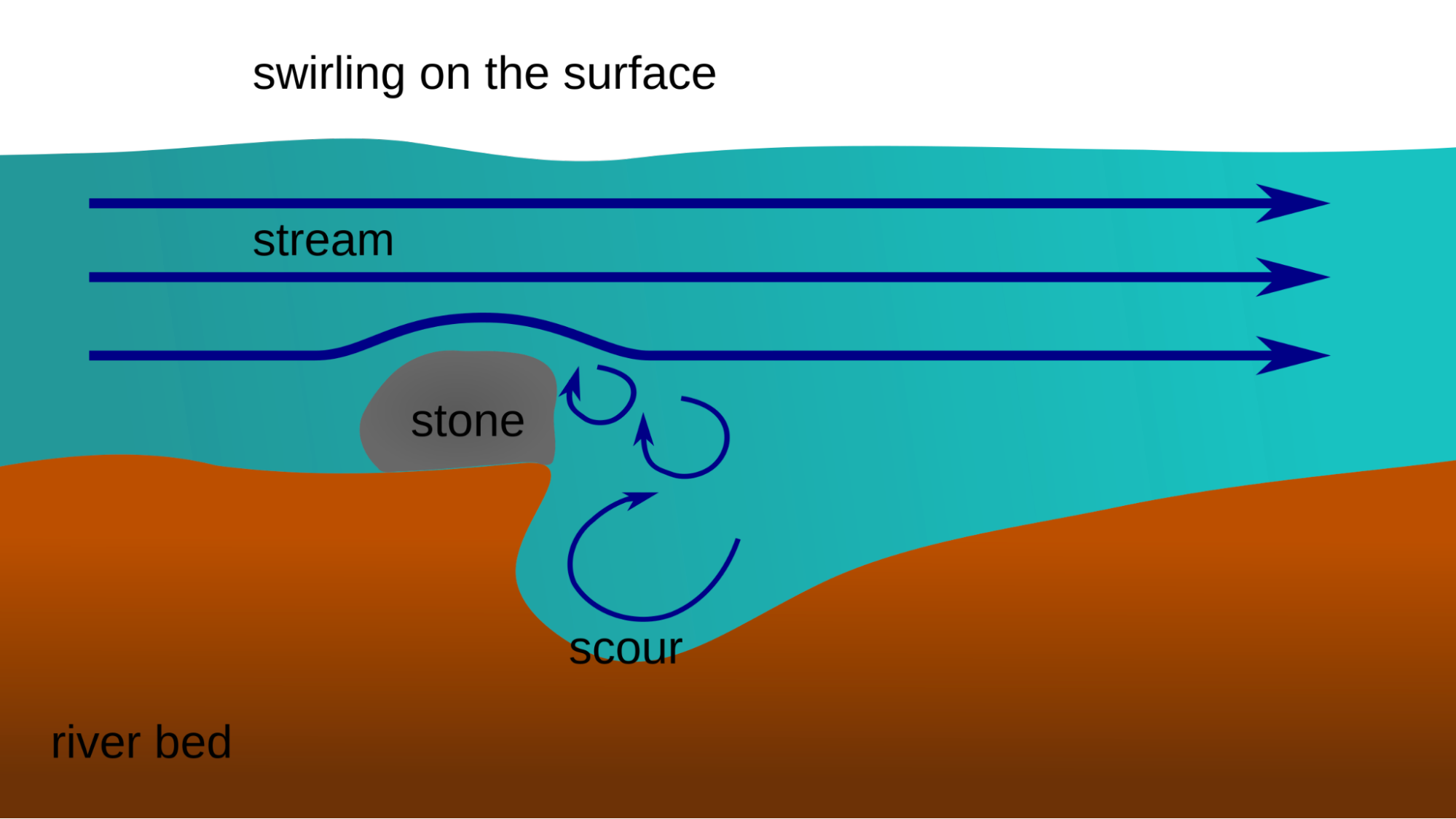
Hydrodynamic scour is the removal of sediment such as silt, sand and gravel from around the base of obstructions to the flow in the sea, rivers and canals. Scour, caused by fast flowing water, can carve out scour holes, compromising the integrity of a structure.
Source: https://en.wikipedia.org/wiki/Hydrodynamic_scour ↗
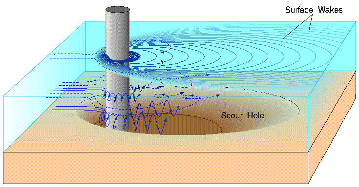
It is a notable cause of bridge failure ↗ and a problem with most marine structures supported by the seabed in areas of significant tidal ↗ and ocean current.
It has been estimated that 60% of all bridge failures result from scour and other hydraulic-related causes.
Source: https://en.wikipedia.org/wiki/Bridge_scour ↗
According to these posts by UkrHydroElectro from 2018 — one gate roughly drains 100 cubic meters of water per second. Let’s take that at least since 02 January 2023 three gates are fully opened and two are half-opened. And let’s ignore over-drainage and overtopping for simplicity, we’ll say that they cancel each other out. That means we have roughly 400 cubic meters of water drained each second. Giving us roughly 5_356_800_000 cubic meters drained, if only counting the last 5 months before the breach. And we’re even not counting the opened gates on the HPP.
#Does it mean that the dam broke on its own?
No. If someone leaves a stove lit, and the house catches fire — we don’t say “the house burned down on its own”. It is an arson.
Albeit being monumental and robust, dams require professional maintenance and precise manipulation. And they can fail for a variety of reasons: https://en.wikipedia.org/wiki/Dam_failure ↗, including poor maintenance.
#What about the evidence of an explosion?
Well, currently evidence of an explosion is unverifiable and contradictory. It doesn’t mean that there were no explosions. It only means that our evidence for the explosion demolition version is not enough. See this section for more: Explosion theory evidence and critics
#So russia did it by explosives or by ill-maintenance, does it really matter which way?
It doesn’t matter for russia — they are guilty either way and should face the consequences. But for the world, it is important to learn how exactly the breach happened, and how we can prevent similar disasters in the future.
If some terrorists want to blow up a hazardous infrastructure that they captured — there’s little we can do to prevent that. We had to act before, not letting terrorists into the place. But if this disaster happened by knowing or unknowing mis-maintenance — then the world could foresee this catastrophe and intervene with social, political, economic, and raw force months before the breach. Actually, the OSINT community has been warning the world about a possible catastrophe, but our existing international institutions could not or would not prevent the disaster.
If this evidence of scouring/washout indeed was sufficient to cause the dam breach — then russia should’ve noticed the breaking structures at least 38 days before the breach. Thus before we prove explosion or erosion, we already have a case of criminal inaction.
May I also remind you: aside from many suffering cities and villages, russia also currently occupies the Zaporizhzhia Nuclear Power Plant ↗.
This is the end of the overview part. The rest of the article covers general info about the dam, shares a detailed timeline of the events before the breach, and explores why the explosion version doesn’t have enough evidence currently.
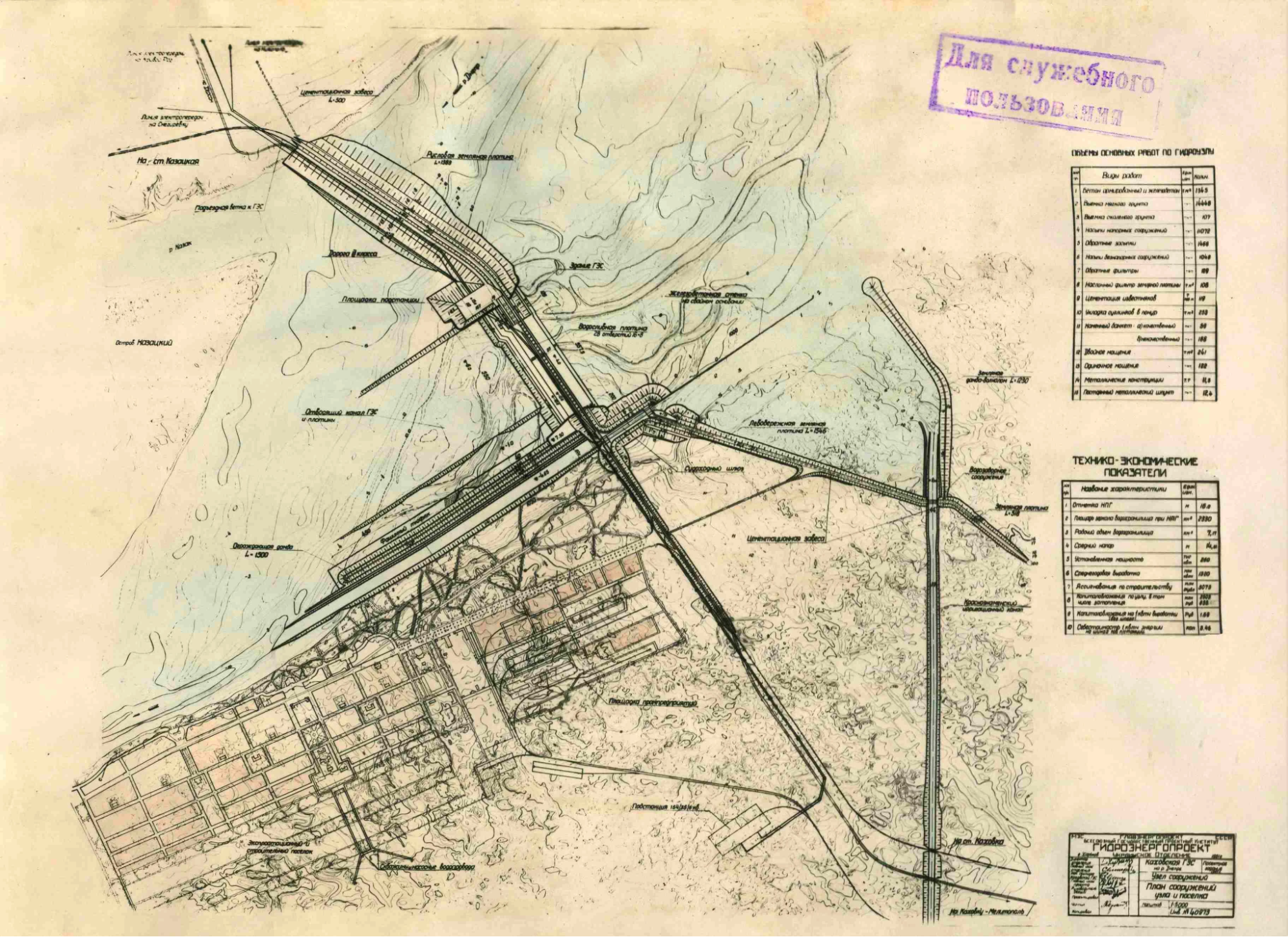
#Blueprints
Поперечний розріз Каховської греблі: 1 - водозливна гребля; 2 - анкерний понур; 3 - металевий шпунт; 4 - водобій; 5 - рисберма; 6 - зуб ніздрюватої конструкції з металевого шпунта

Поперечний розріз Каховської ГЕС: 1 - фундаментна плита; 2 - металевий шпунт; 3 - донний водоскид; 4 - залізобетонний міст
Source: https://defence-ua.com/army_and_war/v_ukrgidroenergo_rozpovili_jak_rashisti_tsilesprjamovano_pidirvali_kahovsku_ges_za_najgirshim_variantom-11812.html ↗
Lower quality: http://energetika.in.ua/ua/books/book-3/part-2/section-4/4-3-grebli-gidrovuzliv ↗
~
Illustrations author: Andrew Barr ↗
Source: https://twitter.com/andrew_barr/status/1668979717989335042 ↗
#Timeline
Disclaimer on the date-time stamps: while satellite timestamps can be trusted, news and individual uploads' exact date-time is often hard to verify. Such dates here should be read as “not later than”.#Feb-Jul 2022
From the very start of the massive invasion, russia used HPP as their stronghold, gunpoint/artillery position.
#26 Feb 2022 (right after full-blown invasion)

Source: https://twitter.com/DefTechPat/status/1497664117557149700/photo/1 ↗
High res: https://nypost.com/2022/10/20/russia-planning-false-flag-attack-to-blow-up-kherson-dam/ ↗
#~

Source: https://twitter.com/PerEkstrom1/status/1598273815670575104 ↗
Source: https://twitter.com/osintjourno/status/1672917019694358529 ↗
More russian positions on the dam/HPP below: ru positions on the dam
#Shipping lock
The shipping lock channel is close to the Dam/HPP. Ukraine has been hitting the bridges over the lock and russian positions near the lock since around Summer 2022. Russia dumped gravel into the lock channel around October 2022. As a result, the lock became inoperable. I won’t be covering these events in this document, giving this as a background.
Source: https://twitter.com/ArtisanalAPT/status/1580049554618994688 ↗
#August 2022
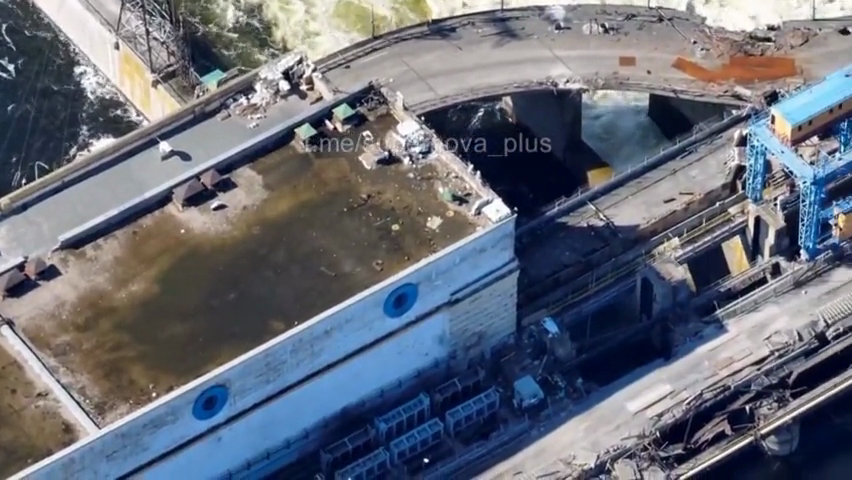
#~ 10 August 2022
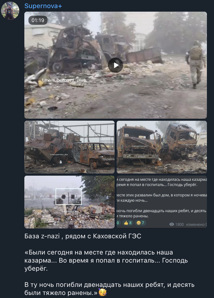
Ukraine does a strike on the s-bridge near the HPP
Source: https://t.me/supernova_plus/8736 ↗
Notes:
-
It seems like gates #1 are intact
#~
Source: https://www.youtube.com/watch?v=JDEKUJ7EfN8 ↗
Source: https://www.youtube.com/watch?v=HiXpVpwpO14 ↗
Source: Ху@вий Херсон (TODO: find the source)
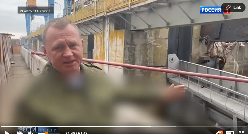
#13 August 2022 — russian propaganda reports no critical damage to the dam
Probably the gates #1 are intact at this moment, as only “broken glass” damage is reported by the HPP worker.

Video source: https://t.me/tass_agency/150855 ↗
#September 2022
#02 September 2022
Satellite confirmation of s-bridge hits from 02 September

Source: https://twitter.com/ArtisanalAPT/status/1567270449226072066 ↗
#06 September 2022 — 4 out of 6 HPP turbines are working
UkrHydroEnergo news article claims that on 06 September 2022 two of the six turbines are under maintenance, and the other four are working.
КАХОВСЬКА ГЕС: ПРАЦЮЮТЬ ЧОТИРИ З ШЕСТИ АГРЕГАТІВ
Станом на 6 вересня Каховська ГЕС продовжує працювати в енергосистемі по комерційно-диспетчерському графіку, видаючи від 40 до 110 Мвт/год потужності плаваючим графіком на підстанцію Новокаховська.
Source: https://uhe.gov.ua/media_tsentr/novyny/kakhovska-ges-pracyuyut-chotiri-z-shesti-agregativ ↗
#September-October 2022 — regular HPP crew is not allowed to the dam
За словами генерального директора ПрАТ «Укргідроенерго» Ігоря Сироти, з вересня 2022 року захоплена Каховська ГЕС не працює ↗ і використовується окупантами виключно як фортифікаційна споруда. Водночас росіяни підняли затвори на ГЕС і скидають там воду.
Source: https://investigator.org.ua/ua/news-2/254079/ ↗
Наші співробітники, ризикуючи своїм життям, виконували професійні обов’язки. Гідно пройшли водопілля навесні 2022 року, працювали на станції та підтримували обладнання в належному стані. З жовтня окупанти перестали допускати українських працівників до управління гідроелектростанцією та на її територію.
Source: https://uhe.gov.ua/media_tsentr/novyny/nova-kakhovka-ce-ukraina ↗
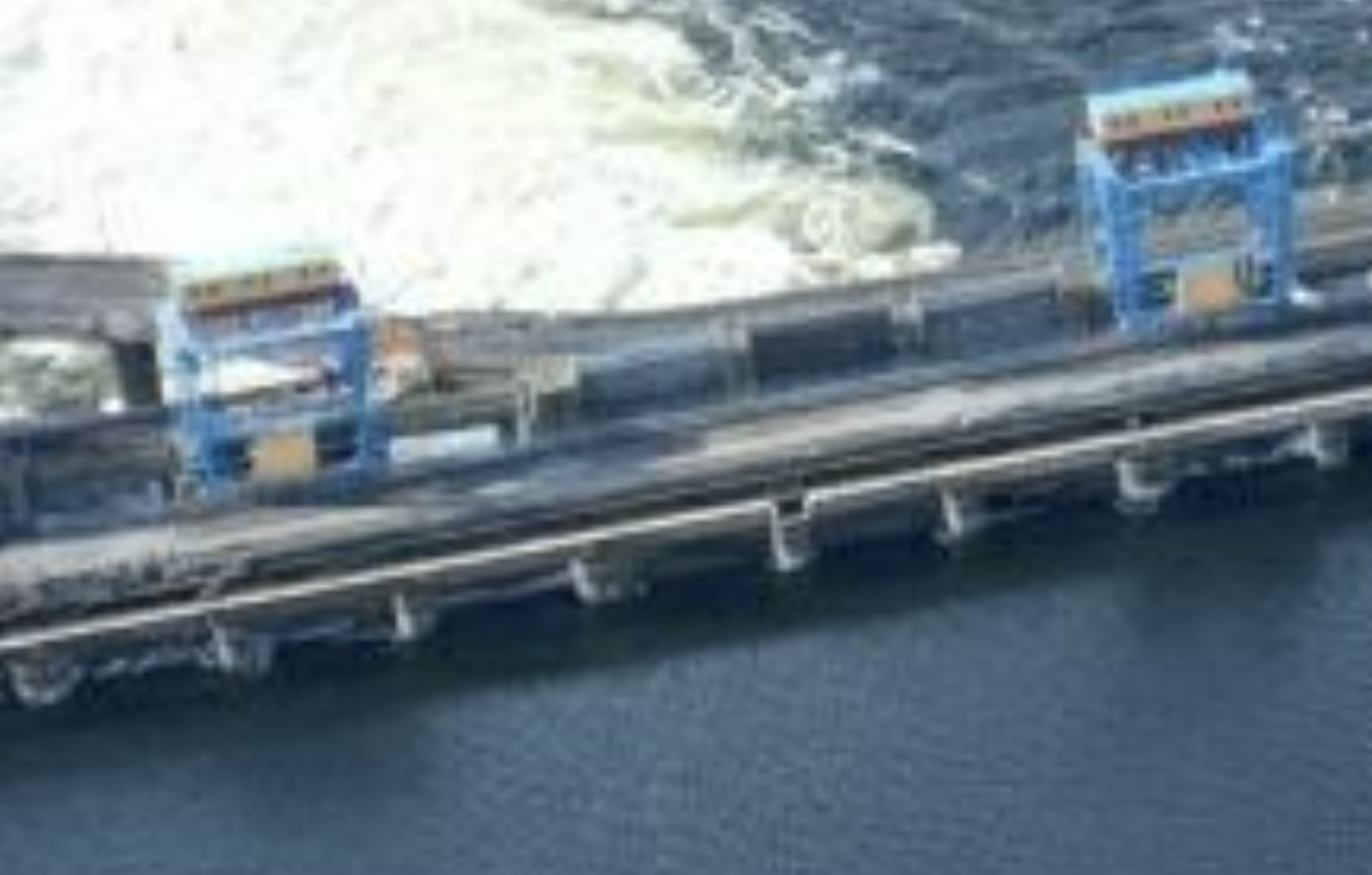
#Date unknown — sluice gates n. 1 are damaged
First sluice gates and rails above it were damaged after 02 Sep 2022, exact date, what caused the damage and if the barrage is damaged — is unclear.

Illustrative March 2023 photo, more close-up photos: 5 March 2023.
#~
Rails and probably some cables over gate #1 are damaged
Source: https://twitter.com/osintjourno/status/1672889664624107522/photo/3 ↗ (repost)
#~
Source: https://twitter.com/pustota/status/1668176418310705153 ↗
Note: on the screenshot it is claimed to be 19 August 2022, but the video cannot be verified (unavailable) and this date contradicts the 02 September satellite photo above: in September the gates top is not damaged and there’s no narrow passage near the gates.
Judging by the position of the cranes and the #3 sluice gates hanging on the first crane hooks — these photos were taken after 11 Nov 2022.
Notes
- There’s no evidence of an attempt to fix gates #1.
- Gate #3 is open, hanging on the crane hooks
- Gate #12 is open.
TODO: explain gate #12 strangeness. Tweet: https://twitter.com/kddsky/status/1674189679749484547 ↗ - This seem to be the same guy, as seen on 25 March 2023 — inside HPP
#~
from an interview with Ukraine's Maj. Gen. Andriy Kovalchuk from a Dec 2022 article:
Kovalchuk considered flooding the river. The Ukrainians, he said, even conducted a test strike with a HIMARS launcher on one of the floodgates at the Nova Kakhovka dam, making three holes in the metal to see if the Dnieper’s water could be raised enough to stymie Russian crossings but not flood nearby villages.
Source: https://www.washingtonpost.com/world/2022/12/29/ukraine-offensive-kharkiv-kherson-donetsk/ ↗
Notes:
- There could be translation issues:
- Ukraine has also been hitting bridges over the Kakhovka Dam lock channel, Kovalchuk could be referring to it. And people tend to call the whole structure just “dam”.
- Not sure what 3 holes the article talks about. The only known broken gates are gates #1.
- Need more evidence.
#October 2022
#01 October 2022 — unverified: possibly leaking sluice gate n.1
#18 October 2022

Source: https://www.reuters.com/resizer/dmE48LYtjnEUBGxnXDhFmeDdh8o=/1920x0/filters:quality(80)/cloudfront-us-east-2.images.arcpublishing.com/reuters/DHX5ECYWJRM35LLZPQTE57G4LE.jpg ↗ from https://www.reuters.com/world/europe/is-kakhovka-dam-ukraine-about-be-blown-2022-10-21/ ↗
Notes:
- Gate #12 is open (strange one).
- By the algae lines, going straight to the HPP, I’d say that HPP gates are open.
- Gates open: #5 #7 #9 — #12 — #14, #16, #18
- Gates are opened in an opened-closed-opened pattern, in two symmetrical sets, like they used to be opened before the occupation. I think there’s still someone who knows what they are doing.
#November 2022
#02 November 2022 — unverified: possibly leaking sluice gate n.1
Turbulent water stream is visible near the #1 gates

Note:
- It is unclear, but probably gate #1 is leaking
- No gates are open (#12 is unclear)
- Cranes are over #25 and #17 gates
#10 November 2022 — opened gates n.23
#11 November 2022 — russians leave the right bank & blow up road sections
#Nighttime (probably):
russians leave the right bank of Dnieper and blow up part of the road bridge, above 3 spillways, adjacent to the right bank (to the ground dam on the right bank side). Sluice gates #26, #27 and #28 are damaged and are leaking afterwards.

Source: https://t.me/gruntmedia/22064 ↗
Source: https://www.youtube.com/watch?v=YA2norBud1s ↗
Notes:
- There’s a significant explosion wave, shaking even the HPP building where the camera stands.
- See https://twitter.com/Maxar/status/1591158455808954368 ↗, https://twitter.com/grntmedia/status/1591848165636206592 ↗, https://sentinelshare.page.link/kecu ↗ for leakage on #26, #27, #28 gates.
- There’s a significant outflow from gates closer to the right bank. Those are probably gates #23 that were opened the day before. Those gates would be closed in the morning (see next photo)
#Daytime, 10:25 in the morning

Source (high res): https://news.liga.net/ua/politics/news/okkupanty-vzorvali-neskolko-proletov-mosta-k-plotine-kahovskoy-ges-sputnikovye-snimki ↗
Source: https://twitter.com/Maxar/status/1591158455808954368 ↗
Notes:
-
The sluice gates #23 that were opened before the explosion are now closed. Is it possible that the explosion itself shut them?
-
The separator wall between HPP and spillway dam is intact (highlighted)
-
It's not clear whether an explosion on the other side could increase the leakage from gates #1.
-
Gates #12 are raised, but there’s no visible outflow.
-
HPP intake sluice gates are partially open (not clear if there’s significant flow through the turbines)
-
HPP crane is intact, but will be seen damaged on 11 March 2023 (the wall stands)
-
Is it #1 or #2 gates leaking? See white water behind the 1-2 gates separating pillars.
#Damaged part from aside
Source: https://t.me/news_5ua/28396 ↗
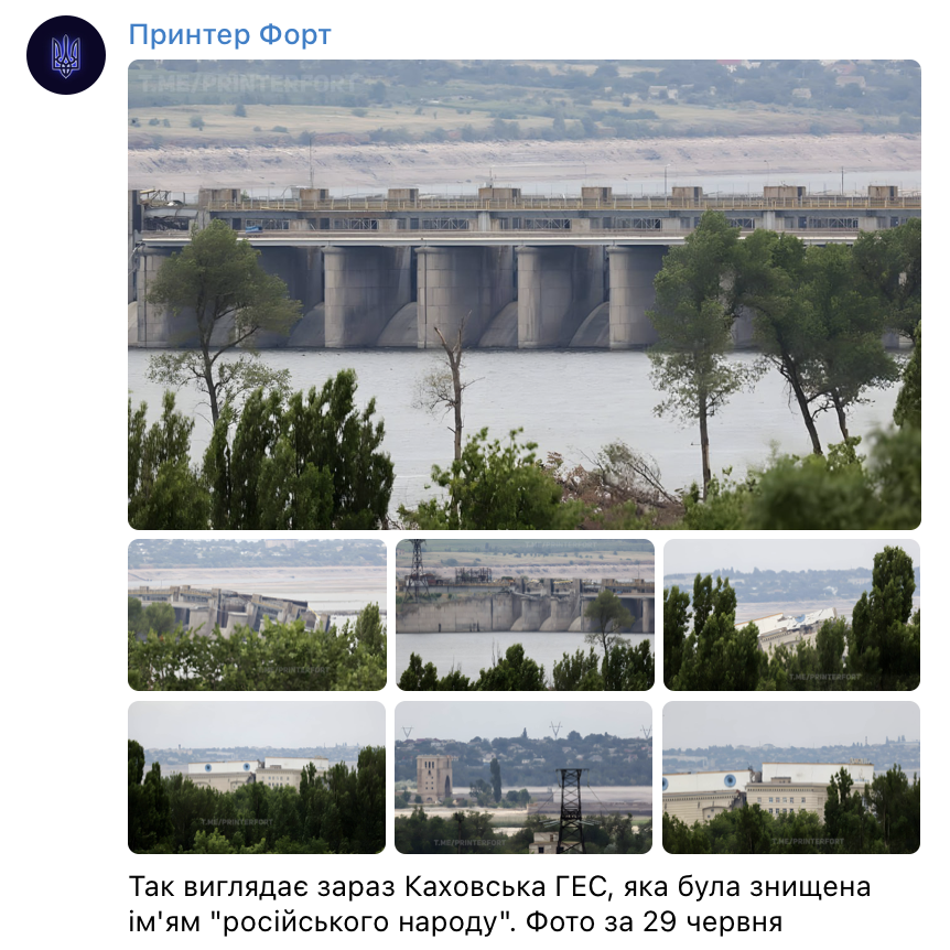
#Close-up photo of the damaged part, from 29 June 2022 (after the breach)
Source: https://t.me/printerfort/5182 ↗ from 29 June 2023
#13 November 2022
Source: https://twitter.com/grntmedia/status/1591848165636206592 ↗
Source: https://t.me/gruntmedia/22197 ↗
Notes:
- Note the waves, hitting the separator wall from the side.
- Gate #5 is open
- Gate #12 is open, but there’s no visible outflow.
#15 November 2022
Source: https://sentinelshare.page.link/ccg8 ↗
Notes:
- Seems like still only one of the gates is opened (probably #5, as it was on 13 Nov)
- Between 15 Nov 2022 and 01 Jan 2023 more gates will be opened.
#January 2023
#01 January 2023

Source: https://sentinelshare.page.link/mXNi ↗
Notes:
- Note the length and area of the white turbulent water. It spans far behind the river floor protective layer. But it’s unclear how deep that turbulent water layer can be.
- For gates state see 02 January 2023 notes.
#02 January 2023
Notes:
- State of the gates won’t change ever after
- Gate #5, #6, #7 are open
- It is unclear, #3 might be already raised, hanging on the hooks (judging by the strong turbulent water in the gate #3 channel)
- Gate #12 is raised, no visible outflow
- Gates #26, #27, #28 are leaking
#February 2023
#19 February 2023
Source: https://pbs.twimg.com/media/FpWYSYwWcAEidHH?format=png&name=medium ↗ via https://twitter.com/huruank/status/1627374284514418690 ↗
Note:
- Gate #3 is raised, hanging on crane hooks
- Gate #5, #6, #7 are open
- Gate #12 is open, but there’s no visible outflow.
#March 2023
#01 March 2023 — low water levels in Kakhovka Reservoir due to constant drainage
Lower water level in the Kakhovka Reservoir, Enerhodar City, near ZNPP:
Энергодар ...
после подрыва дамбы Каховской ГЭС уровень воды в районе ЗАЭС ....
Source: https://t.me/supernova_plus/17958 ↗
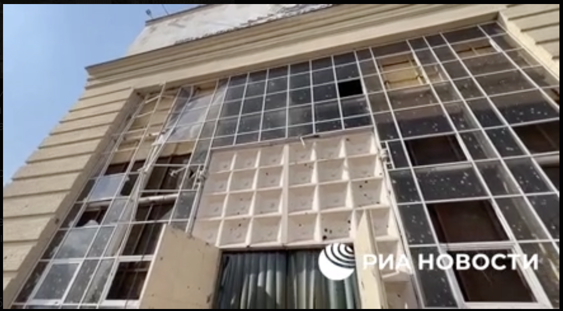
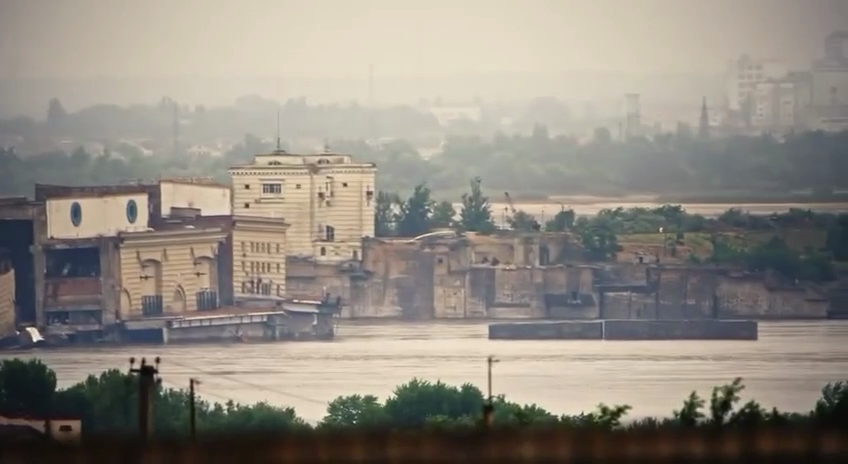
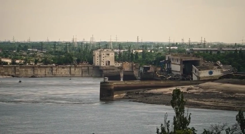
#5 March 2023 — date unconfirmed — close-ups of dam/HPP damage
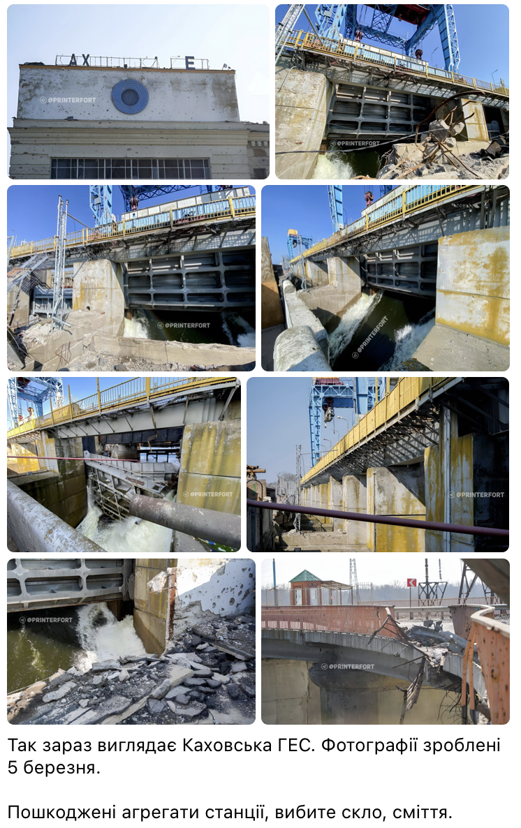
Source: https://t.me/printerfort/3790 ↗
Later: https://twitter.com/NOELreports/status/1632820747470077953 ↗
#~
ru propaganda video, from the same spot, form about the same time:
Source: https://t.me/rentv_news/86832 ↗ (ru propaganda)
Warning: There are doubts about the date of the images above. Doubts are related to the seemingly high water level in Gates #1 photo, which was low in the December-April period.
Doubts 1: https://twitter.com/davidhelms570/status/1633278604405555201 ↗
Doubts 2: https://twitter.com/Flash_news_ua/status/1632868901053779972 ↗
At most, they were made on 5 March. At least 13 Nov 2022 (because of the #3 gate raised)
#11 March 2023 — water drainage, HPP crane destroyed
Каховская ГЭС .... федерация гавна спускает воду с Каховского моря…
Source: https://t.me/supernova_plus/18264 ↗
Notes:
- Debris screens and sluice gates on HPP are opened (orange arrows)
Crane that operates HPP sluice gates is destroyed (red arrow)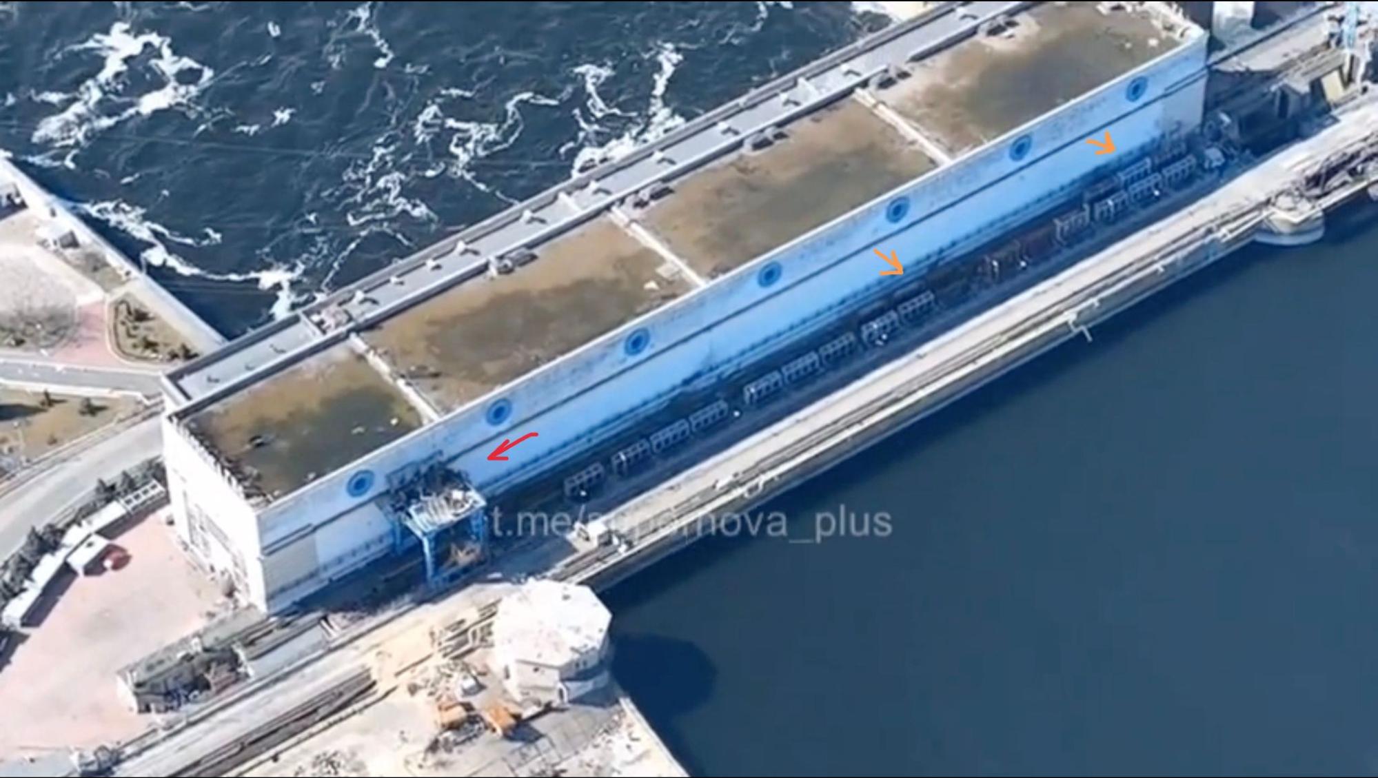
#24 March 2023 — UkrHydroEnergo: "russian gate management doesn’t make any sense"
«МАНІПУЛЯЦІЇ РОСІЯН ІЗ ЗАТВОРАМИ КАХОВСЬКОЇ ГЕС НЕ МАЮТЬ ЛОГІЧНОГО ПОЯСНЕННЯ» — Ігор Сирота
Ігор Сирота каже, що наприкінці лютого – початку березня росіяни спустили Каховське водосховище майже до критичної відмітки. Але аномальний зимовий паводок, який трапляється раз на десятки років сприяв його наповненню.
Source: https://uhe.gov.ua/media_tsentr/novyny/manipulyacii-rosiyan-iz-zatvorami-kakhovskoi-ges-ne-mayut-logichnogo ↗
#25 March 2023 — inside HPP

Notes:
- Some noise can be heard on the background. It might indicate that the water is still flowing through the HPP turbines.
- This seem to be the same guy as seen on Date unknown — sluice gates n. 1 are damaged
#April 2023
#16 April - 4 May 2023 — first signs of overtopping
#Sidenote: analysis of the reservoir water management and gates operation
#Dam gates state & management
David Helms ↗ was tracking gates & cranes state, here are his findings + my minor additions

Note: David generously shared the document with me, the screenshot above was taken from it.
#HPP gates state & management

The algae trace on 03 June 2023 photos, just before the breach
is similar to the 18 October 2022 algae trace. This might indicate that HPP intake is open in June, and water is flowing through.
According to the Blueprints, it seems like these are HPP intake gates (closer to the wall), and debris screens (further from the wall).

Source: 11 March 2023 video screenshot.
Tracing back the HPP gates’ state — it seems like they’ve been partially opened since at least 11 November 2022, and it was never changed ever after. And on September 6, 2022 — 4 out of 6 turbines were working: 06 September 2022. Also, note that in 11 March 2023 photos the HPP crane-top is destroyed.
Notes:
- It is unclear how strong is the flow of water through the turbines, but in this video, we hear some strong background noise inside the HPP: 25 March 2023 — inside HPP, which might indicate flowing water.
- It is unclear if HPP river-bottom gates are opened or not (that surpasses turbines)
My speculations:
- it is possible that without fixing the crane — the HPP intake could not be adjusted.
- constant water flow through HPP gates near the separator wall could catalyze the river floor scouring.
#Feb - Jun — Extreme drainage and overtopping
As seen on the gate operation charts above — at least since January 2033 the HPP and the sluice gates were not operated.
This led first to over-drainage and then to overtopping of Kakhovka Reservoir during December 2022 - June 2023 period.
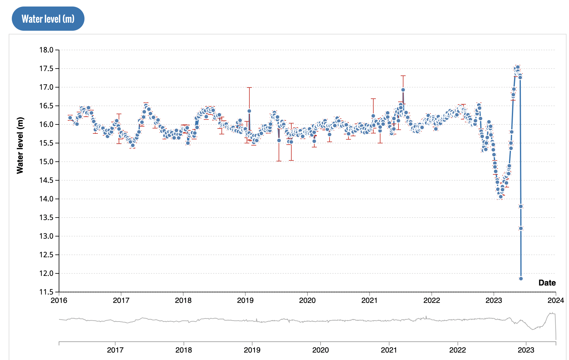
#Kakhovka reservoir water levels (2016-2023)
Source: https://hydroweb.theia-land.fr/hydroweb/view/L_kakhovka?lang=en&basin=Dniepr&lake=kakhovka ↗
Alternative source: https://ipad.fas.usda.gov/cropexplorer/global_reservoir/gr_regional_chart.aspx?regionid=umb&reservoir_name=Kakhovskoye&lakeid=100873 ↗
~
David Helms ↗ @davidhelms570 ↗

1. Ruschist operation of Kakhovka HPP (K-HPP) dam has been reckless. Kakhovka Reservoir (KR) water level has alternated from record low to record high in just 3 months. Loop (6 FEB-6 MAY 2023) shows sand bars receding with rising KR water. ↗#NAFOWeather ↗
Source: https://twitter.com/davidhelms570/status/1655226067425062912 ↗
David Helms ↗ @davidhelms570 ↗
#KakhovkaReservoir ↗ ↗#KakhovkaHPP ↗ 1/ Status Follow-up: 30 May 2023. Over-topping of ↗#KakhovkaHPP ↗ dam continues, now occurring for a full month.
Source: https://twitter.com/davidhelms570/status/1663569718496620544 ↗
TODO: cover why this mode of operation of the Dam was bad:
- Gates should be opened symmetrically (TODO: proof)
- Gates should not be opened for long periods of times (TODO: proof)
- Water levels were below and above normal operation limits (TODO: proof)
- cover rumors of Belarus’ dam breach
- cover UA Dnipro reservoirs water levels.
#28 April 2023 — part of the wall separating HPP & dam breaks
Part of the wall, that separates HPP from the barrage spillways broke and is partially submerged:
It is a few meters thick reinforced concrete structure:
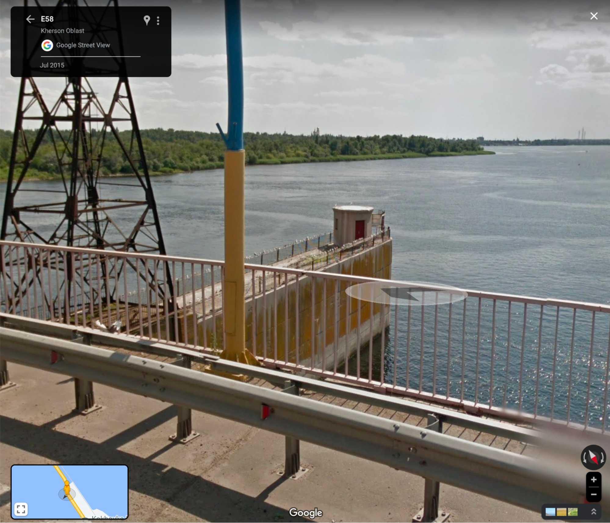
Reference of the wall on google street view.
Notes:
- By 28 April 2023 water has been constantly drained through gates upstream for at least 166 days (since 13 November 2022)
- This break likely indicates that the foundation of the wall is damaged. And further scouring of the river floor is expected.
- Gate #3 is raised on the crane hooks & there’s visible water intake
- Gate #5, #6, #7 are opened
- Gate #12 is raised, no visible water flowing through.

- This is the first time we see the white car with the explosives. AP will write an article about it.
#My speculations on how it happened and what this means
From the tip of the wall to the sluice gates there’s about 100 - 120 meters:
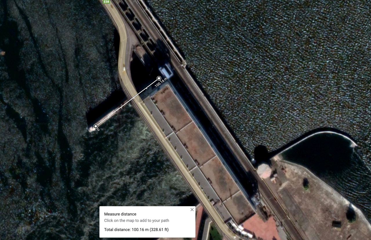
Thus we can deduce the foundation under that piece that broke off:
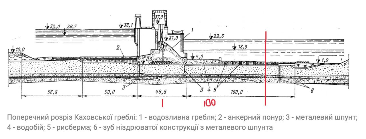
Looks like that tip that broke off was standing on or near the rysberma ↗ or riprap (#5 above). Riprap is a layer of rocks and concrete, that lies right after the 4m thick concrete apron (#4). Riprap protects riverbottom from scouring, breaks and slows down the stream to normalize it with the rest of the water. It is claimed that during Kakhovka dam construction water levels could not be managed properly during floods. Because of that water drainage happened in extreme conditions, which led to river floor scouring just downstream from rysberma. K-Dam river bed was already scoured once
After that wall tip broke off we can say that the riprap was damaged and the river floor was prone to further scouring.
Further water drainage through gates #1, #3, #5-7 and probably HPP gates would further erode the foundation of the wall, leading to the foundations of the s-bridge that would fall on June 1-2-3.
#Sidenote on stream direction
On 13 Nov 2022 we saw some side-waves hitting the separator wall:
And from various pictures from autumn till summer, it seems like generally the turbulent water stream was bending towards the left bank, i.e. towards that wall.
#More speculations on the wall foundation

Kakhovka 2nd HPP presentation screenshot
Source: https://twitter.com/PavewayIV/status/1670627701525295105 ↗
It might be that the tip of the wall that fell off, stood on some edge of support layers. But we can’t rely on the presentation screenshots. Until we have top-down blueprints of the dam, we can’t say much more about the foundation.
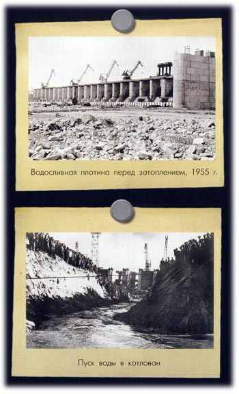
#K-Dam river bed was already scoured / washed out once in 1950s
In 1950-s a flood occurred during the construction of the dam. This forced engineers to drain water through gates on one side of the dam, while water level downstream of the dam was 2 meters below normal — that led to river bed scouring / washout downstream from rysberma ↗ (riprap) for 9m deep.

Source: “Гидравлика зданий гидроэлектростанций” С. М. Слисский, 1970 г., москва, page 251
Source: https://kitab.ttnda.az/upload-files/books/09/1067/qidravlika_zdaniy_qidroelektrostanciy.pdf ↗
Source: https://leg.co.ua/arhiv/generaciya/gidravlika-zdaniy-ges/Page-21.html ↗
#May 2023
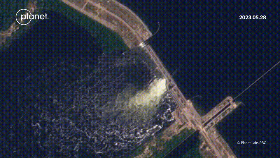
#3 May 2023 — Overtopping
David Helms (@davidhelms570) ↗ on twitter:

5/ @riley_mellen ↗ and @heytherehaley ↗ also published an article for @nytimes ↗ on 17 May 2023 about #KakhovkaHPP ↗ water level. Article included a nice #PlanetLabs ↗ image from 3 May 2023 clearly showing dam over-topping.
Source: https://twitter.com/davidhelms570/status/1663569729770999808 ↗
Photo source by Planet Labs from https://www.nytimes.com/2023/05/17/world/europe/dam-flood-ukraine-kakhovka.html?unlocked_article_code=UgqGFm_l-HDY9W0IeXEiUVJpYIRZmf7fPw_SXutxYnTNV64FXoAOJixCx7GYunM6cKKXEM0ZRiJY2vXswCmwkaidp76LMbpmr-S_tWJAkkf8MqHWeUGDH1BPZrqq27wy8SbhSZGY-vqXrf-x4sEDN1zzREJEtWQ45StbGXHiiI_MIt_E7xCLPd3cR-t3fm0e_3IKfBVdtXQfsXV8HEnNvsqu6B69DwNHty0INqcfJhid_mGmCz4qzYCbZ5yP88FjsPs3ft0iw8OOe4KCb8B76jGzI_sHM54Gx1uk6_GZ7-Qhgw2vPz8sn72GTYABIHKbO5ZrRhKJ_MtT8-foTZFXofC2soJvGZE45g&smid=tw-share ↗
Notes:
- Gates #12 are opened, but we see only signs of overtopping, not a turbulent flow like under opened gates 5-7.
- Gate #3 is probably opened too.
#16 May 2023 — Overtopping
Video source: https://youtu.be/wGacVIhtPR0?t=82 ↗
Notes:
-
інший ракурс на зруйновану стіну, так само видно що одна секція напівзавалена. Не ясно чи руйнування збільшились чи ні.
-
Note gates #12 are opened, but we see only signs of overtopping, not a turbulent flow like under opened gates #5-7.
-
Sand bags appear on the ru occupied side, behind the HPP:
On 28 May 2023 we see other side of the HPP entrance path also has those bags:
We’ll see them close up after the breach on 6 June 2023: Morning:
#28 May 2023
Overtopping

Source: https://twitter.com/ChristopherJM/status/1665948340855422977/photo/3 ↗
~

Source: @maxar via https://twitter.com/gbrumfiel/status/1665974250472177665/photo/1 ↗
#31 May 2023 — russian legislation not to investigate accidents
“Russian government approves legislation to forgo probing accidents and terrorist acts at hazardous facilities before Kakhovka dam explosion”
Source: https://theins.ru/en/news/262443 ↗
#June 2023, before the breach
#1-2 June & 2-3 June 2023 — overtopping & fall of the s-bridge
#Overtopping and falling sections of s-bridge

Source: A satellite image showing the dam three days before its destruction. Pléiades Neo Airbus DS 2023 https://static01.nytimes.com/newsgraphics/2023-06-13-dam-explosion-ukraine/2e8d1037c76891a999bfedb910ba7041a100a11d/_big_assets/images/2023_06_03-airbus-1050_x2.jpg ↗
From: https://www.nytimes.com/interactive/2023/06/16/world/europe/ukraine-kakhovka-dam-collapse.html ↗
Notes:
- Overtopping is clearly seen on all gates
- Trail of algae behind the HPP closer to the left bank, probably indicates intake flow on the HPP
- Gate #12 is raised
#~
This movie made using @planet ↗ imagery shows the roadway failed over 2-3 of June.
Source: https://twitter.com/i/status/1665974703935180801 ↗
#~

JUST IN: High resolution images from @Maxar ↗ showing damage at the Kakhovka HPP BEFORE it failed today. The image on the left is form 28 May. The image on the right is from June 5. The road is clearly gone, indicating the dam may have been starting to fail.
Source: https://twitter.com/gbrumfiel/status/1665974250472177665 ↗
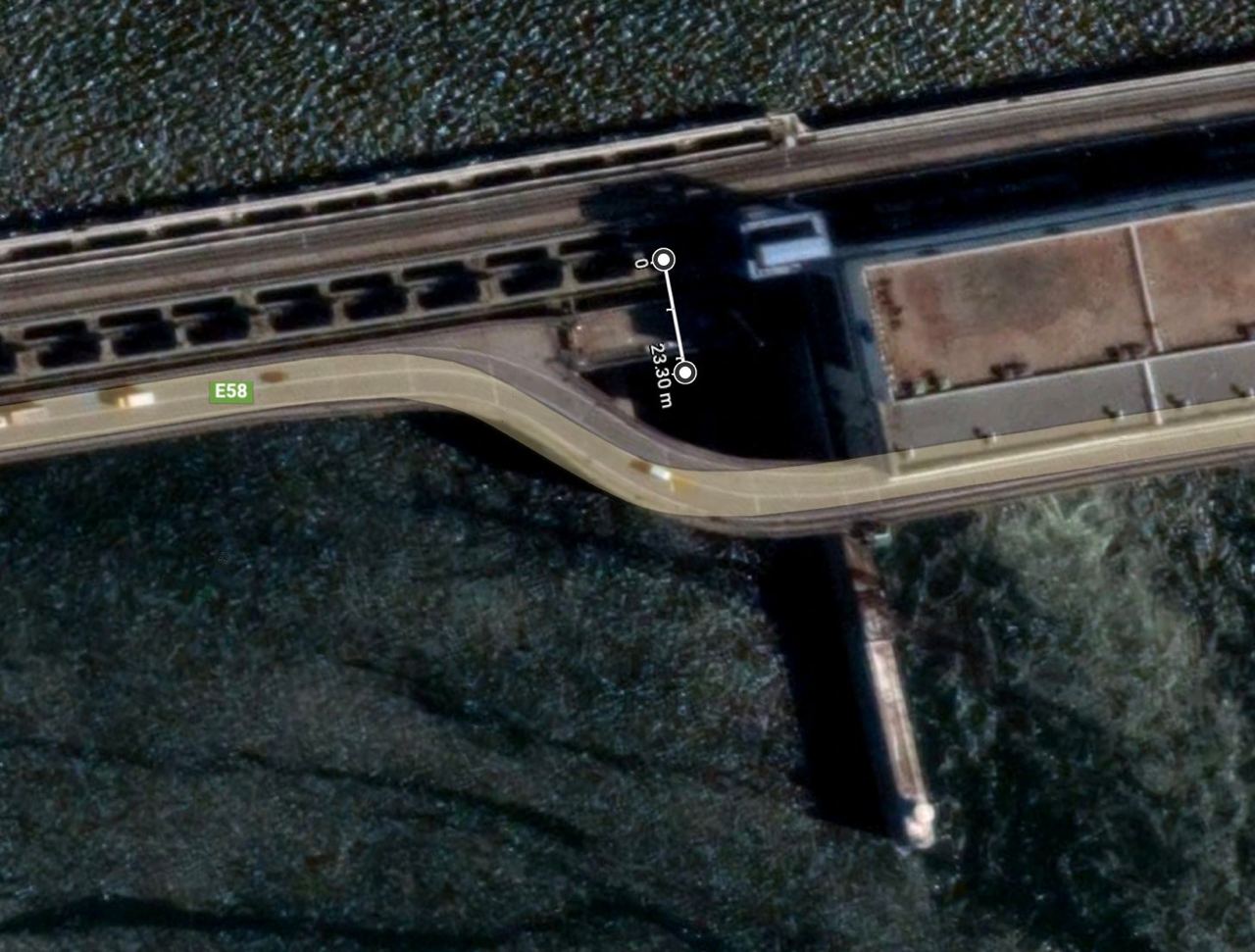
#Analysis of the s-bridge foundation
By the @planet ↗ images above, it seems like the #3 support frame collapsed between 1-2 June, and #2 collapsed between 2-3 June.
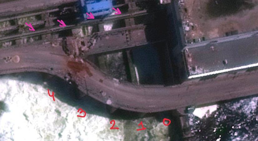
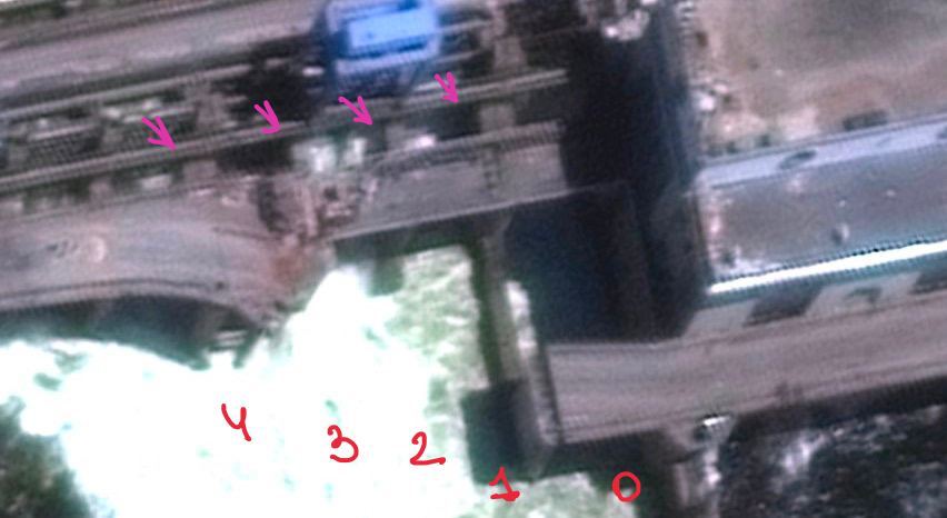
Roughly, there are 23 meters of dam downstream of the sluice gates, after which sits a concrete stilling basin apron. And judging by this scheme — the barrage and apron might be separate constructions. And it seems like #2 and #3 support frames broke off around that barrage-apron border.

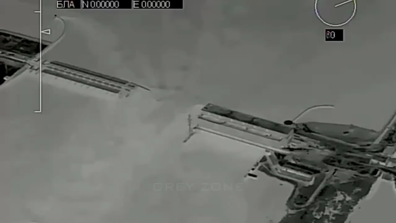
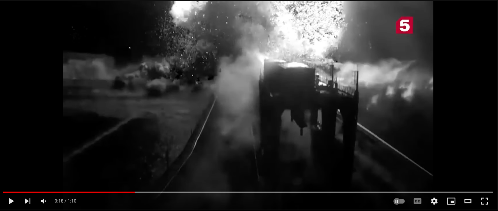
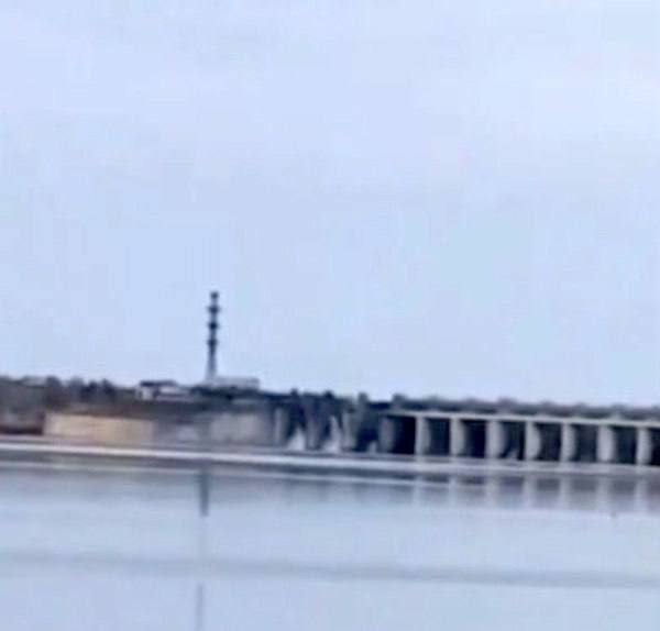
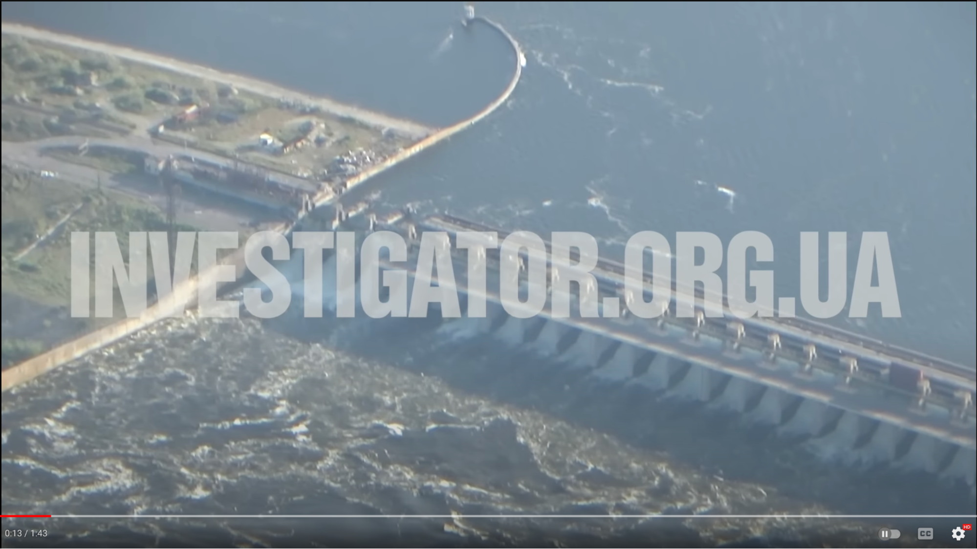
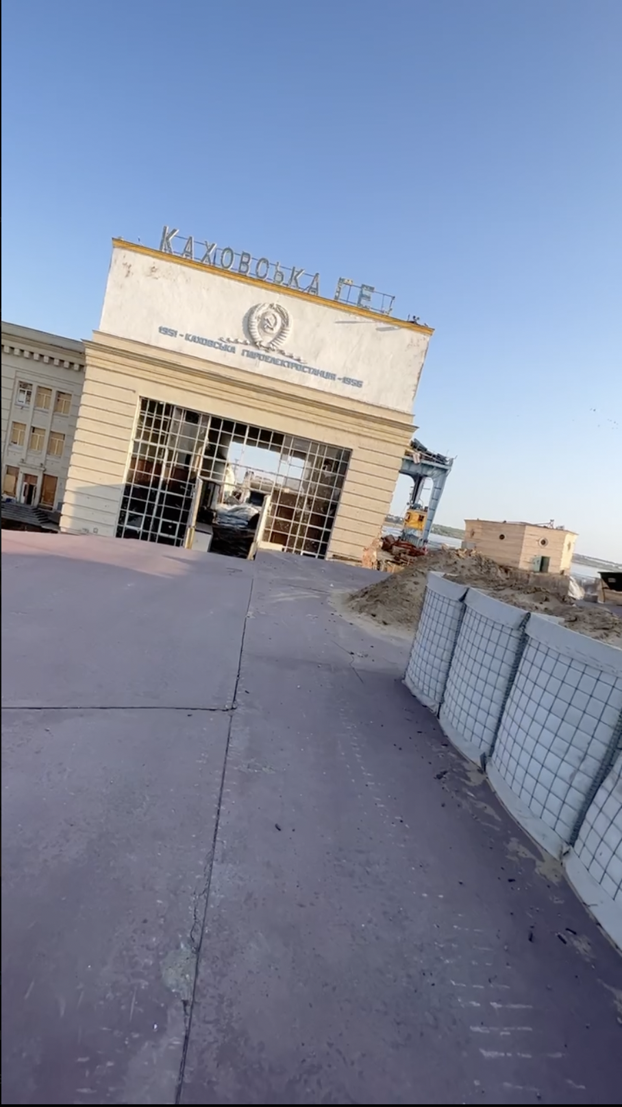
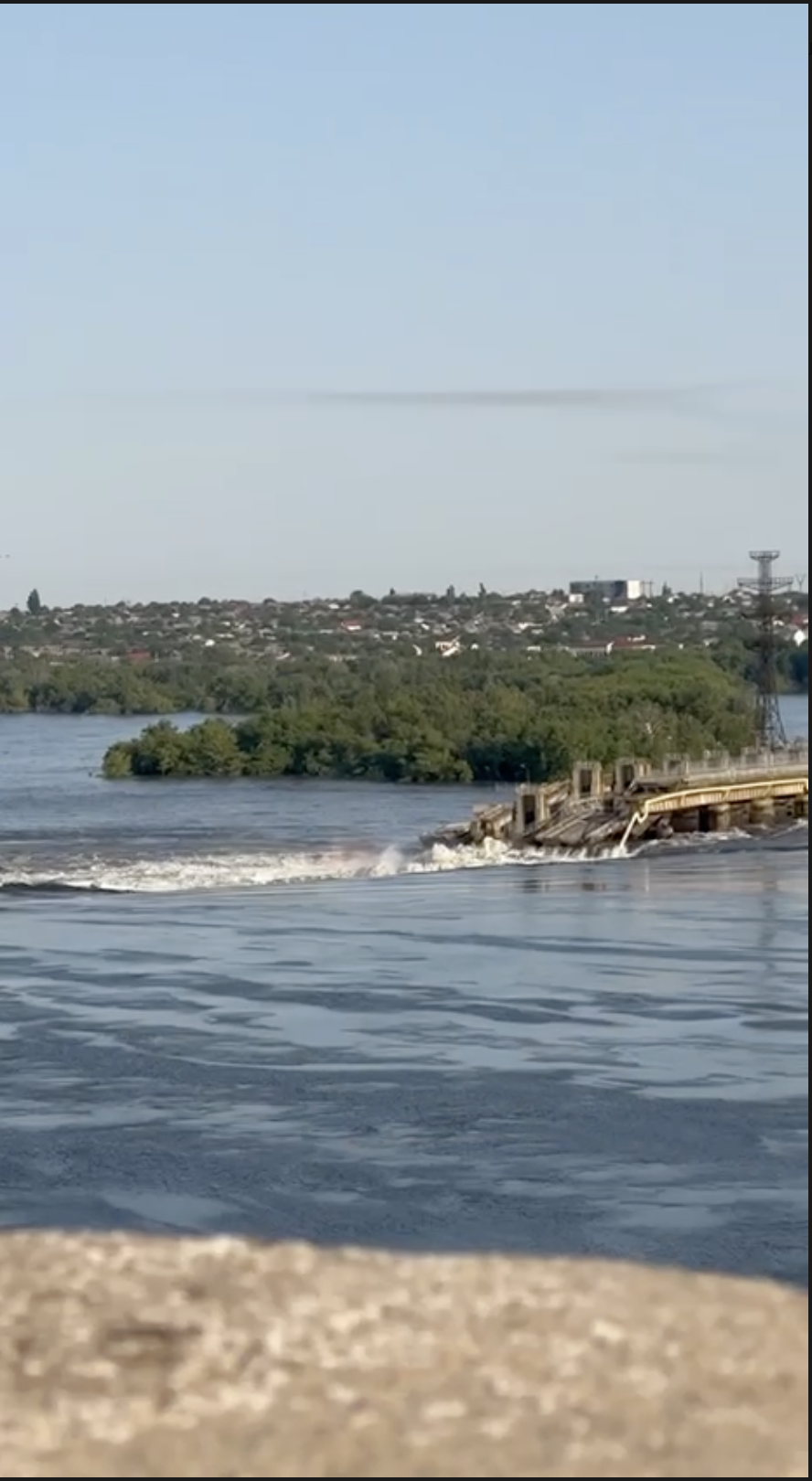
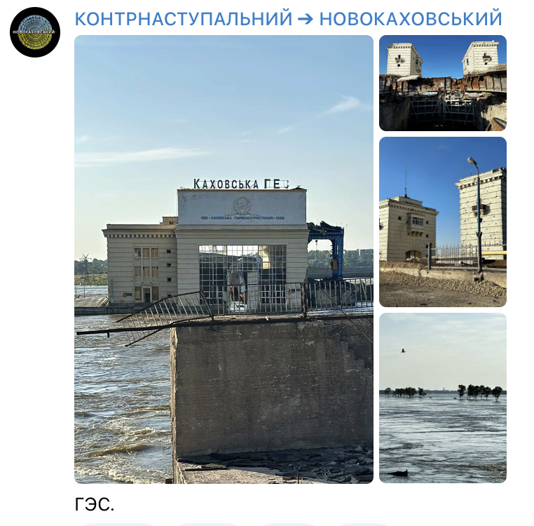
#6 June 2023, breach
#2:18 — local chats report explosions

Source: https://twitter.com/cxemu/status/1674112866088022016 ↗
Note: couldn’t verify independently, somehow this chat history is corrupted for me.
#~ 02:46
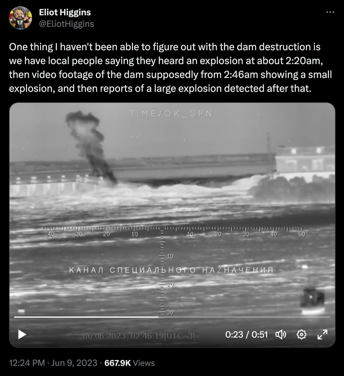
Source: https://twitter.com/EliotHiggins/status/1667100337453277185 ↗
Source: https://t.me/ok_spn/25014 ↗ (ru propaganda)
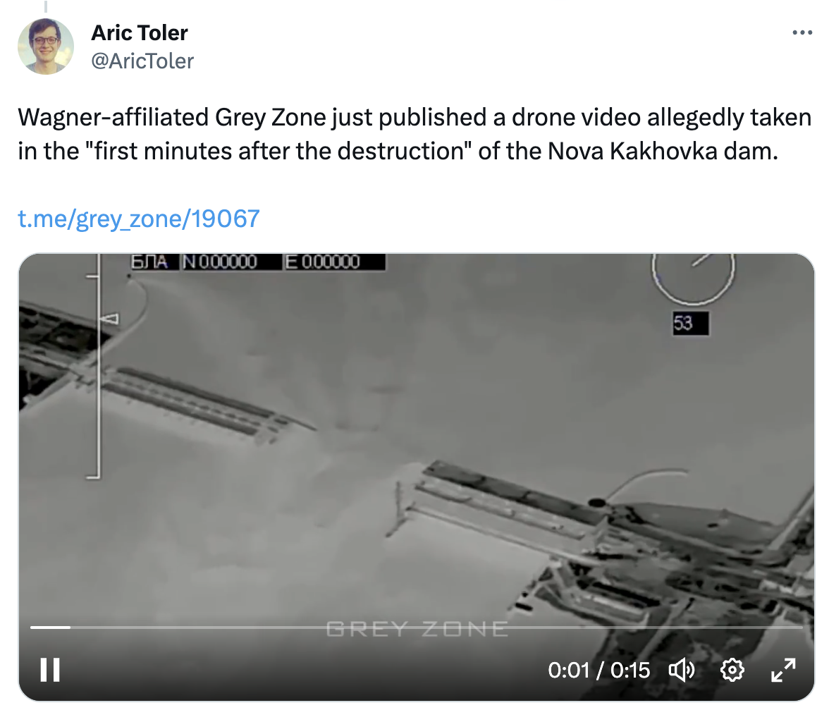
Source: https://twitter.com/AricToler/status/1667558806463578112 ↗
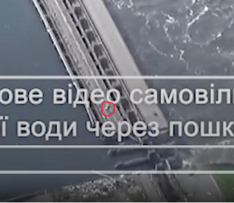
Source: https://t.me/grey_zone/19067 ↗
Notes:
- Seems like the last spillway we see — are around gates #13, but they seem to be not as sinked, as seen on 16 June 2022 satellite images ↗.
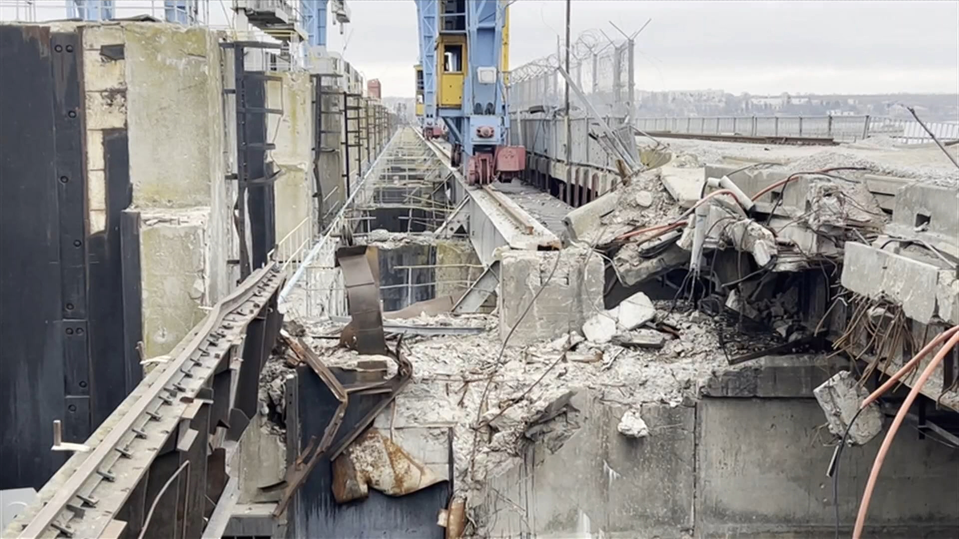
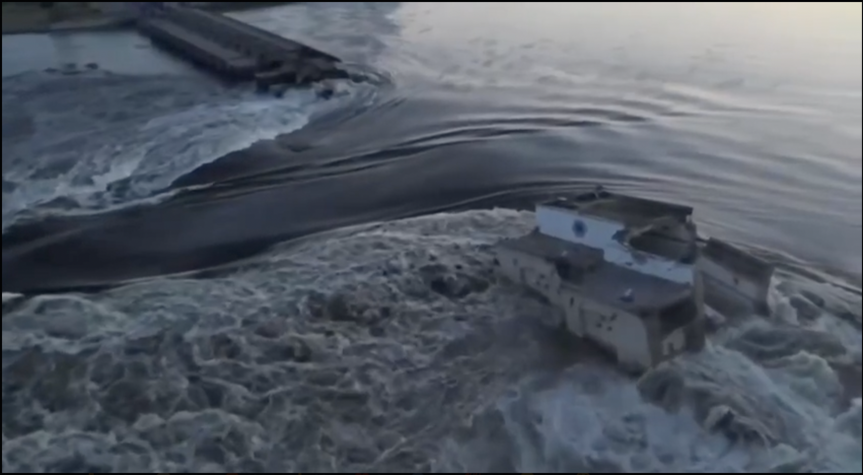
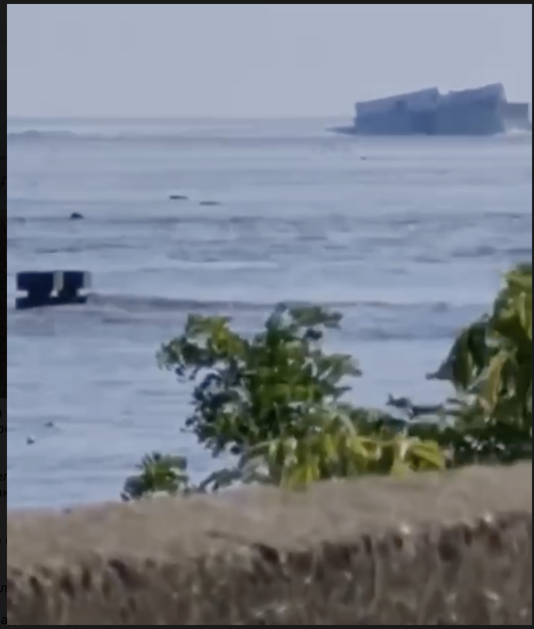
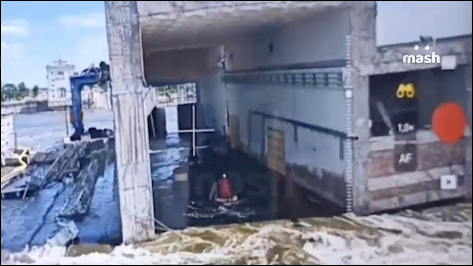
#The HPP starts to break
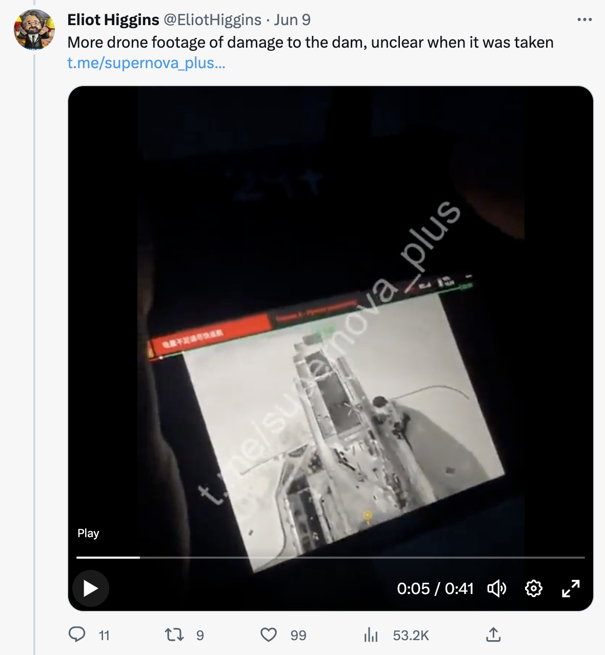
Source: https://twitter.com/EliotHiggins/status/1667142092731154433 ↗
Source: https://t.me/supernova_plus/21001 ↗
#Morning
#~
Source (short): https://t.me/kherson_non_fake/7859 ↗
Source (long): https://t.me/novokah/5192 ↗
Source (long): https://t.me/dva_majors/16949 ↗ (ru propaganda)
#~
Note that HPP entrance used to be on the same level as the reddish floor in front of us.
#~
Video: No incoming hits, that’s just water
, complains about lost equip
#~
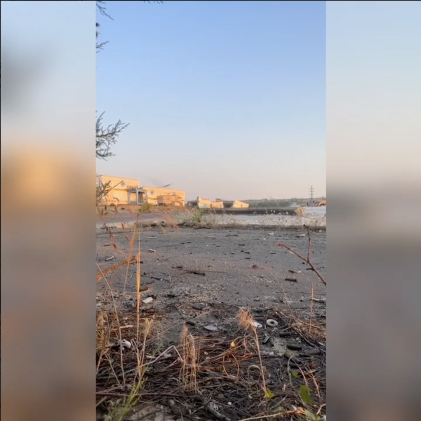
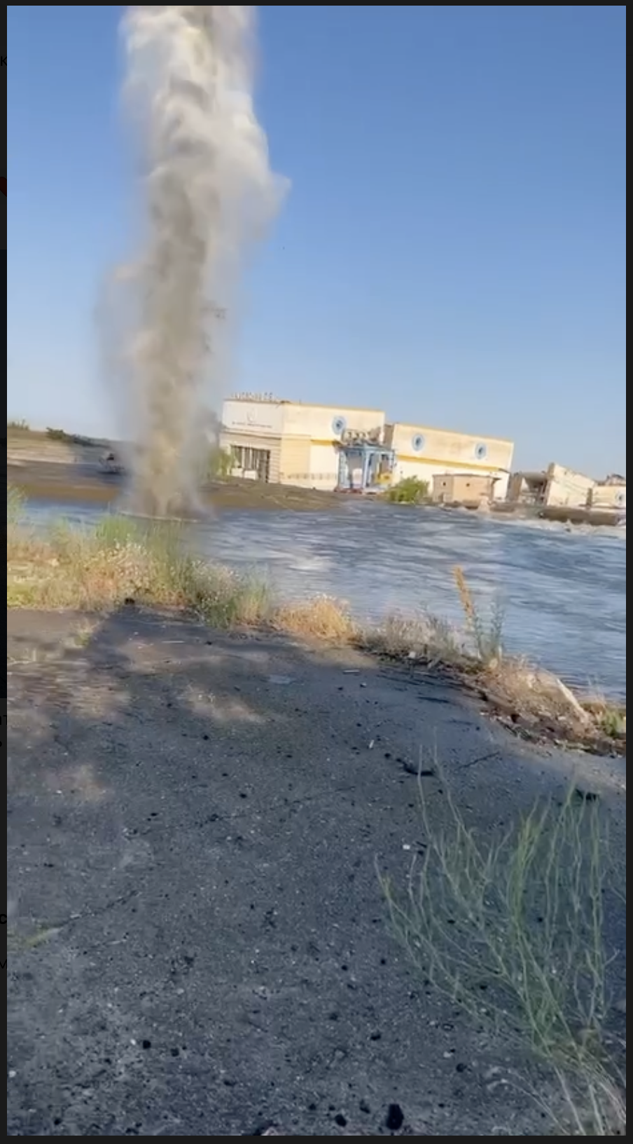
Mines exploding near the shoreline, left bank, upstream from the dam
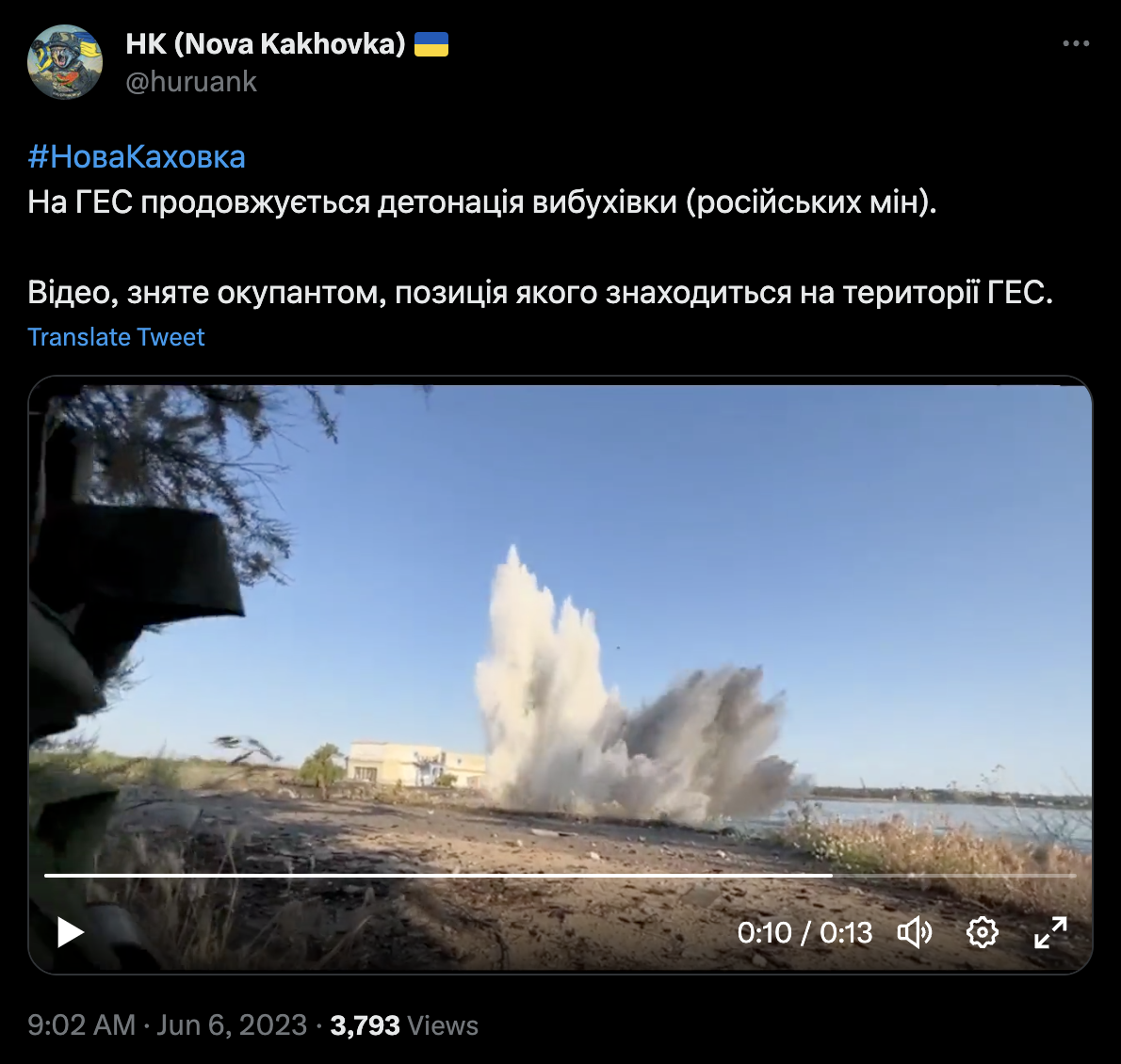
#~
Mines exploding near the shoreline, left bank, upstream from the dam
#~ 7:00 (unverified time)
#~ 7:18 (unverified time)

#~
#~
#~
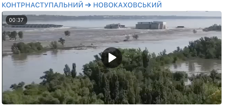
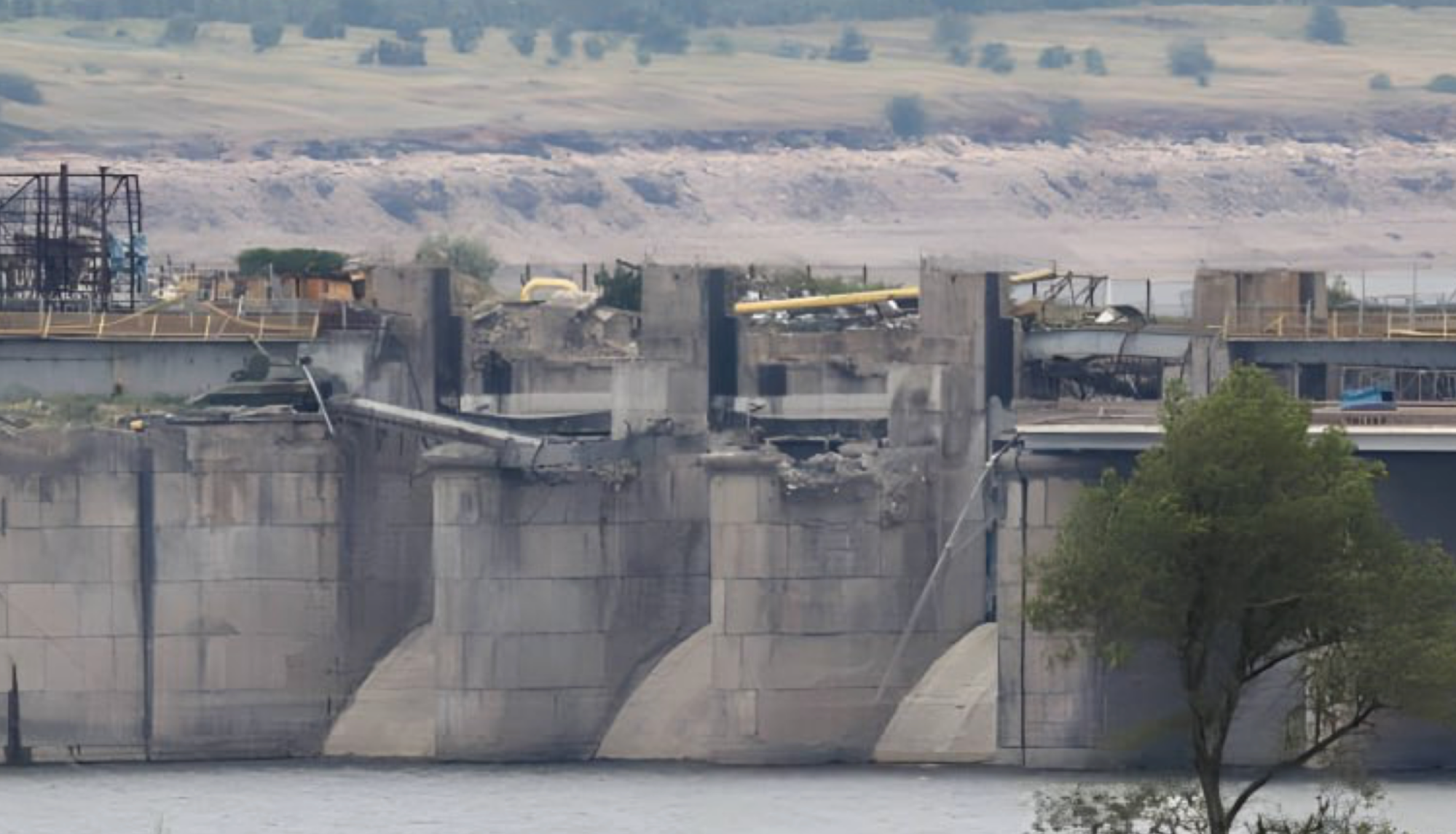
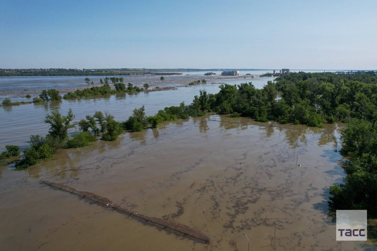
#June 2023, after the breach
#8 June 2023
#~
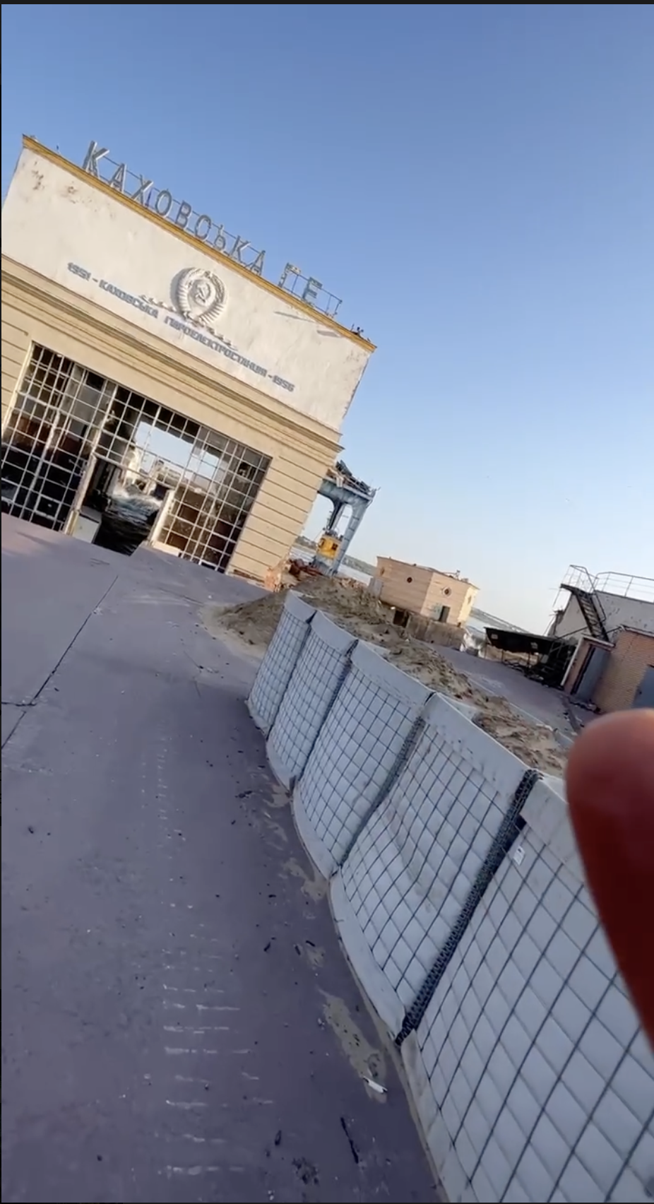
Drone footage of the inside
#10 June 2023
#16 June 2023
Satellite by Maxar
Notes:
- Seems like the last spillway we see above the water on this image is #13
#23 June 2023

Drone video
Source: https://t.me/vosmerkaZ/107 ↗
#~
#27 June 2023
#29 June 2023
#Explosion theory evidence and critics
#NYT article on barrage explosive demolition
Article: https://www.nytimes.com/interactive/2023/06/16/world/europe/ukraine-kakhovka-dam-collapse.html ↗
Tweet: https://twitter.com/nytimes/status/1670441253094260737 ↗
#The article ignores that there are signs of erosion
NYT experts themselves say:
Neither this previous damage, nor the pressure caused by the high water level or the static position of the cranes is likely to have caused the collapse of the dam’s concrete foundation, experts said, unless the concrete was of low quality and already prone to deteriorate. The large flows would also be insufficient to undermine the dam’s foundation unless, for some reason, the concrete apron — the downstream cover placed over the river bottom — contained flaws or the soil was much softer than accounted for in the design.
But they don't know or don't go further discussing signs of concrete apron erosion. While we know that separator wall break and s-bridge fall might indicate protective layer damage. And we know that the soil downstream the dam was already once eroded in 1950s.
#Submerged part of the weir
Photos and illustrations from the article
Source of the video NYT article uses: https://t.me/milinfolive/102188 ↗NYT article claims that since "left" part of the weir is above the water, and on the "right" it is submerged — that means that the part on the right was blown up.
Albeit we clearly see on the photos and illustrations in the article, that the weir is bent (broken) downwards. Not downstream, downwards, into the soil under the weir. And if the soil foundation of the dam was intact — there'd be nowhere to bend to.

Here we can see a V-shaped break of the weir
If the dam was blown up — it caused a change in water flow, which caused water to scour the soil foundation, which caused the weir to bend under its own weight. Or it could start with upstream progressing scour, creating a hole under the weir, which caused it to break under its own weight.
Sidenote: another perspective to show that the weir bent downwards, not downstream:
And we know that after the initial breach — there was some scouring under the constructions:

Here is a screen shot showing that the whole turbine hall now is 4-5m below the road level (much better visible in the video) and even below the water level. The turbine hall sitting on a massive foundation is still more or less intact, but below it the sand was washed away. 7/x
Source: https://twitter.com/DraftnDepth/status/1666797145364787200 ↗
Thus this bend that NYT article highlights doesn't prove anything. There had to be soil erosion before the weir could break down.
#Satellite detecting explosions at or near the dam
just before the dam gave way, American intelligence satellites captured infrared heat signals that also indicated an explosion.
How precise is the measurement, where exactly it was detected, how strong was the explosion, and when exactly did it happen? We have no hard data on this, just the claims of some U.S. officials.
We also have this FIRMS fire detection (likewise, not sure about the accuracy) :
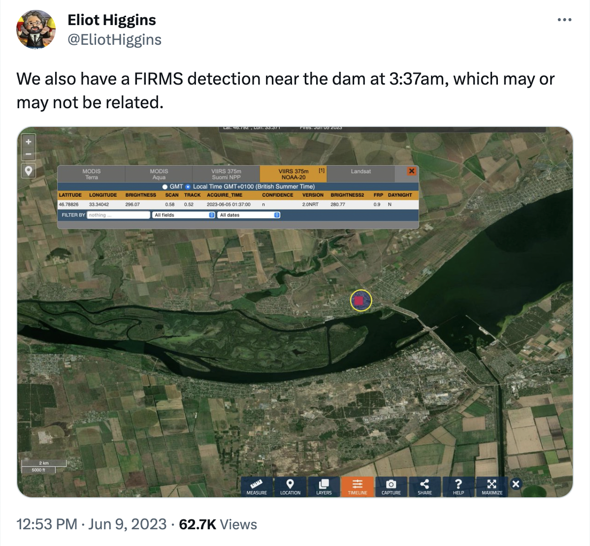
TODO: get data on the FIRMS accuracy
#Seismic activity
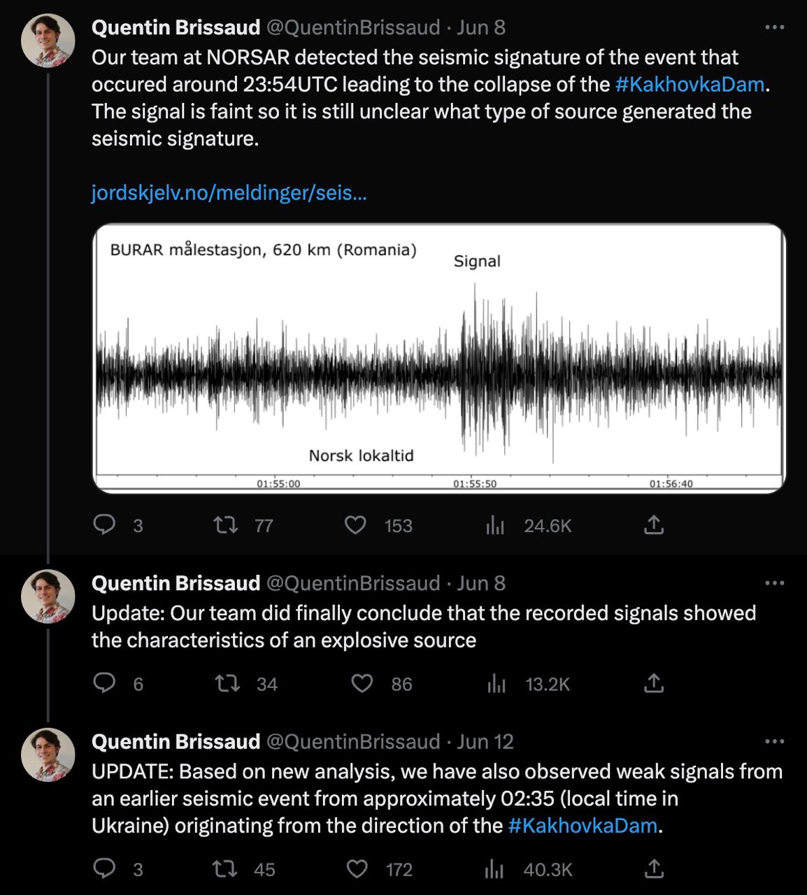
Notes:
- Local chats report “explosive” sounds at around 2:18 local time (not 02:35)
- It is not clear if 21 meters high and 46 meters wide reinforced concrete barrage break and under-the-water fall could cause similar seismic signals. We also know that the HPP building failed separately, after the main breach in the barrage. Could that cause the first and the second “explosion” signal?
- Location precision and force of the explosions detected by the seismic sensors are unknown and are not verified by other teams.
- Could the flowing mines or artillery duels cause similar signals?
- It would be interesting to compare that signal strength to other explosions in the area, like:
- FAB on 1 June 2023: Російська армія з авіації вдарила по Бериславу, Козацькому та Новій Каховці: що відомо ↗
- Or bigger ones like detonation of an ammo storage facility on 11 July 2022: https://www.youtube.com/watch?v=YMc2cUzEZaw ↗
TODO: This is one group's opinion. We need more consultations to determine if the seismic signal could be caused by the break-fall of the weir onto the river floor (massive concrete structure).
#Car with explosives on the dam
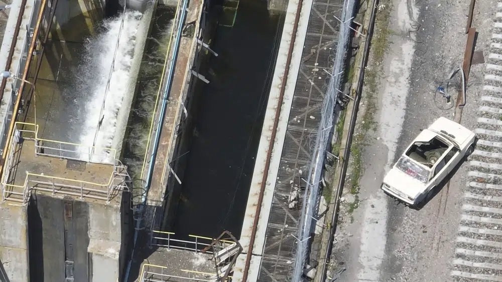
19 June 2023: AP published an article ↗ with drone footage of a car, loaded with explosives.
The issue is that the car stood there since at least 28 April 2023, and was standing there after the breach.
Though it is yet another proof that russsia thought that the integrity of the dam was less important than stopping UA forces from crossing the dam.
EDIT: AP has updated the article to confirm that the car still stands on the dam, and didn’t cause the breach.
#Allegedly intercepted russian transmission near the dam, around the time of the breach
The source is claimed to be from ZSU. Quoting the interception (my translation attempt):
02:20 – How is the situation? That’s firstly, secondly, get ready, get ready, everything on command, did you read me?
02:20 – Как обстановка? Это раз, во-вторых, в готовности, в готовности, всё по команде, как принял меня?02:20 – It’s all done here, done, it’s going [or “flowing”]. 02:20 – Тут все уже, все, пошло.
02:21 – Roger that, roger that, move to the point, to the point, take everything with you. 02:21 – Принял тебя, принял, выдвигайтесь туда на точку, на точку, забирайте все.
02:21 – But we won’t be able to take anything now. 02:21 – Та мы не сможем уже ничего забрать.
02.30 – Emergency. If you wonder, it’s all done here, the point of retreat is done, water is full. 02.30 – ЧП. Если что, тут все, точка отхода закончена, вода полная.
02.34 – Move out to the point where you were deployed and evacuated. 02.34 – Выдвигайтесь туда, где вас забирали и оставляли.
02.34 – They can’t exit, everything is flooded.
Source: me on https://twitter.com/kddsky/status/1674149635345006592 ↗
02.34 – Выйти не могут, все затоплено.
At the moment it’s impossible to verify if this is authentic and if it is related to the dam breach. It is not clear what was happening by the context of the dialogue.
#Andrew Barr’s thread on Kakhovka Dam
Diving deep into the explosive demolition version:

Source: https://twitter.com/andrew_barr/status/1668979717989335042 ↗
A thread on why it was an explosion with a subthread on how it could be scouring:
Source: https://twitter.com/andrew_barr/status/1671138072380014593 ↗
#Consequences
TODO: Should this section exist?
Too huge a topic to cover. Ukraine’s civic population and the ecology of the region suffered the most. Both russian and ZSU’s positions suffered. It’s unclear whether this had any influence on UA counteroffensive, but it definitely could. In a positive or in a negative way — hard to say.
#Appendix
Here I collected all useful and not links and photos that might be needed later.
#Useful links
ОСНОВЫ ГИДРОТЕХНИКИ - БЕТОННЫЕ ПЛОТИНЫ
https://leg.co.ua/arhiv/generaciya/osnovy-gidrotehniki-9.html ↗
SPECIAL KHERSON CAT thread on Kakhovka Dam
https://twitter.com/bayraktar_1love/status/1563180256160231426 ↗
#Other materials
#Dam drone footage before the war, upstream
Part 1: https://www.youtube.com/watch?v=_9BB4QJBa-w&t=0s ↗
Part 2: https://www.youtube.com/watch?v=lQf-QazJGBQ&t=93s ↗
#Brigade fixing road over the lock < Jul 2022
Source: https://t.me/rian_ru/172081 ↗
#~ 10 Aug 2022
Probably under the lock bridge:

Source: https://t.me/supernova_plus/8747 ↗
For reference under the lock bridge photo, from before the occupation times:

#Sep 02 confirmation of Lock and s-bridge hits

#02 Sep 2022 — Lock bridge damage

#Reference photos
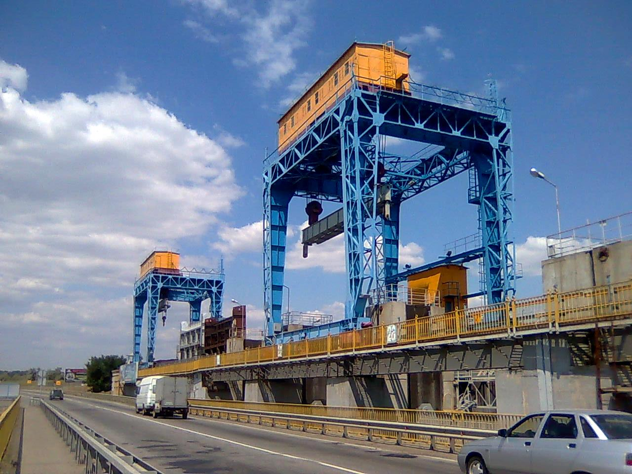
#Birdview of the dam
This photo is used in the article header.

Source: https://en.defence-ua.com/media/illustration/articles/82063286aa051fa9.jpg ↗
#Google Maps view
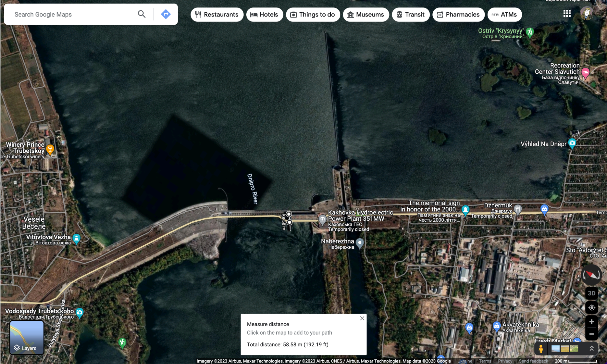
Source: https://www.google.com/maps/@46.7782633,33.3735299,4109a,35y,56.5h/data=!3m1!1e3?entry=ttu ↗
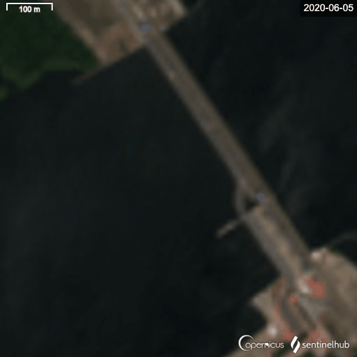
#2020-06-05 .. 2023-06-28 Gif
Sentinel Hub satellite images for three years before the breach
Same but for 2016-2023: https://sentinelshare.page.link/qENV ↗
Video for 2016-2023: https://www.youtube.com/watch?v=musf2s0ZfQ4 ↗
#Open gates ~ 2013
opened-closed-opened pattern, symmetrical gates opened
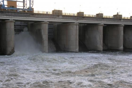
#Gates opening in 2018
#10-04-2018 — Two opened + HPP
Draining water, opened-closed-opened pattern, gates opened symmetrically to HPP
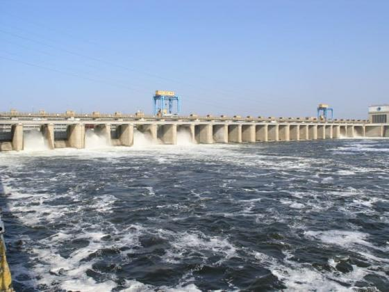
#11-04-2018 — 4 opened + HPP
Draining water, opened-closed-opened pattern, symmetrical opened gates layout
Source: https://uhe.gov.ua/media_tsentr/novyny/na-kahovskii-ges-vidkrito-4-zatvori-dla-propusku-vodi ↗
Source: https://www.youtube.com/watch?v=Y0ekG1NFgEU ↗
Note:
- this was seen from the satellite https://youtu.be/musf2s0ZfQ4?t=10 ↗
#14 April 2018 — 6 opened + HPP
Draining water, opened-closed-opened pattern, gates opened symmetrically to HPP
#HPP from upstream

#HPP from left bank, upstream
#HPP crane other side

#~

#Cranes up-close
#russian positions on the dam
#Names
List of russians, who were based on the dam:
#Photos from the site


#17 Aug 2022
Source: https://t.me/supernova_plus/9109 ↗
Source: https://t.me/Separ13_13/3190 ↗ (ru propaganda)
#Position on the bottom of the river — unconfirmed
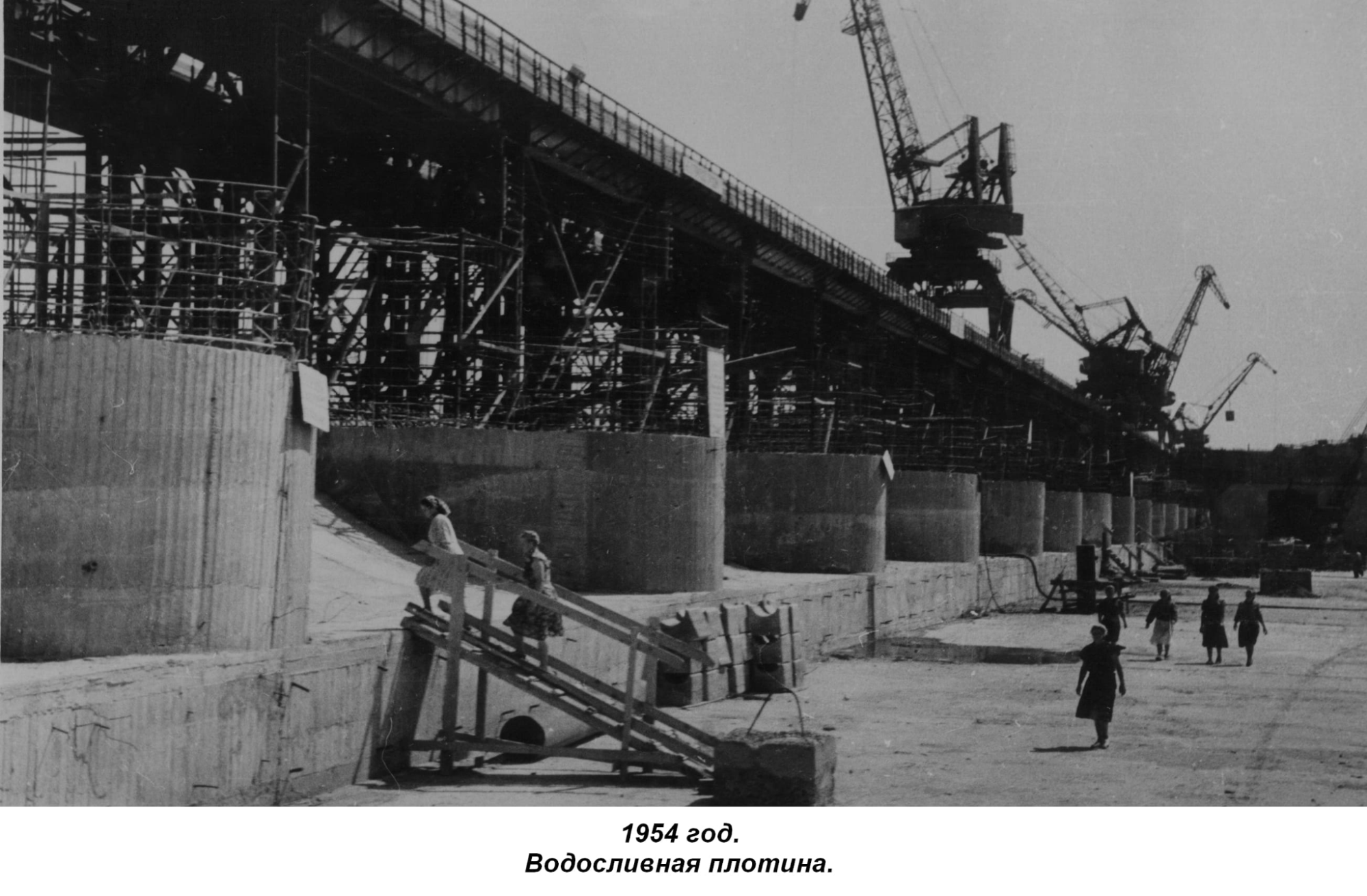
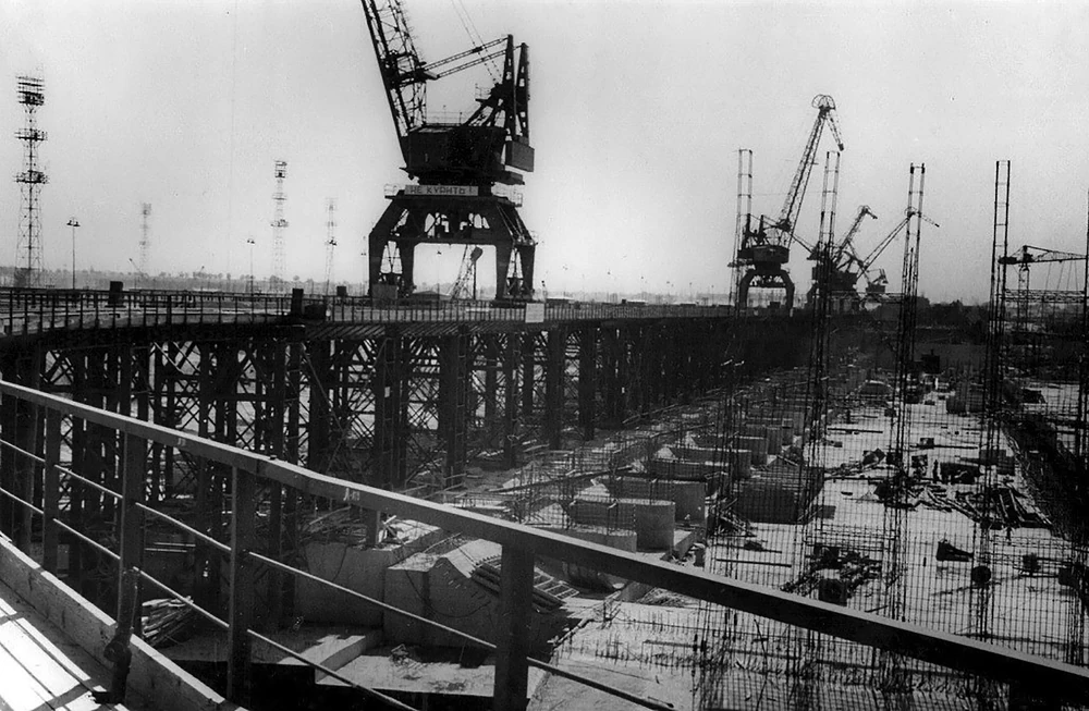
#Historic photos
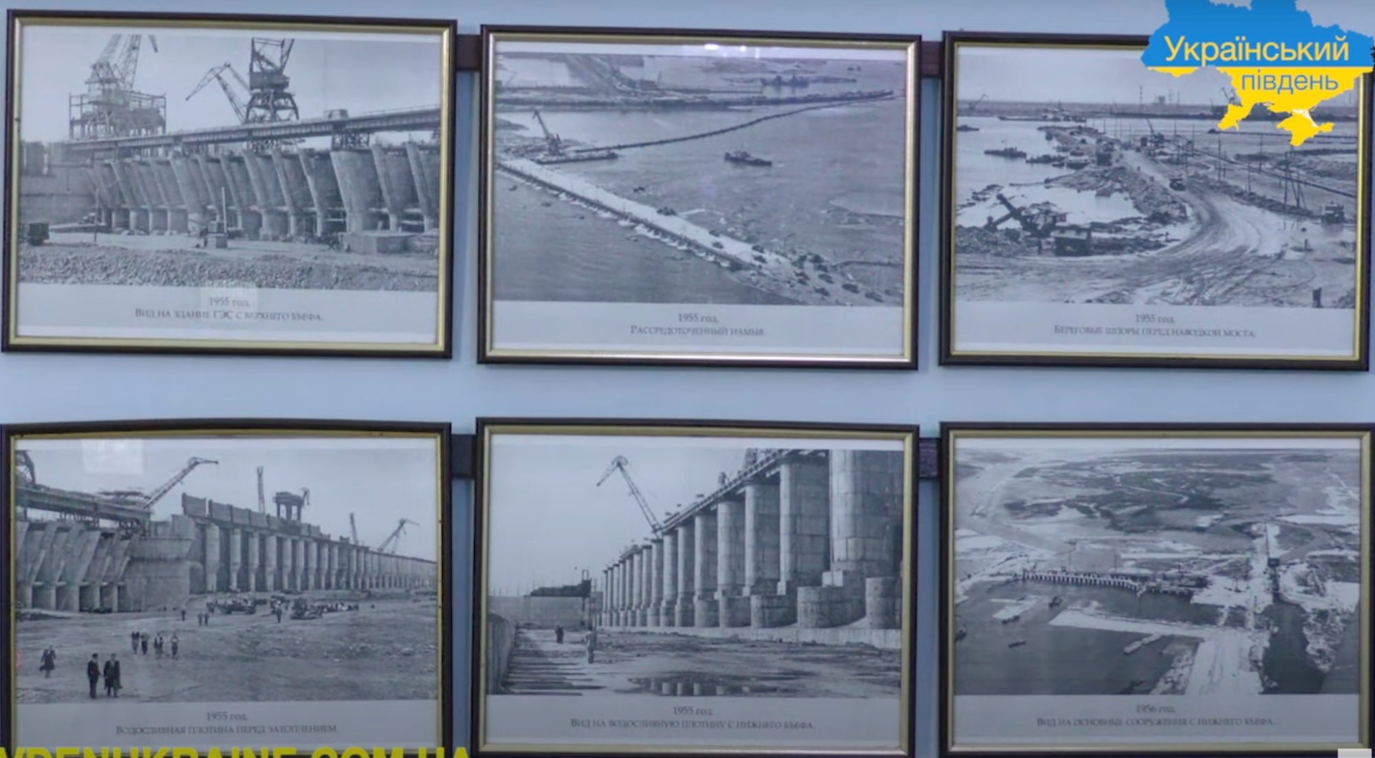
В 1956 г. была введена в эксплуатацию на полную мощность нижняя ступень Днепровского каскада — Каховская ГЭС с водохранилищем полезным объемом 6,8 млрд. М3.
Source: https://leg.co.ua/arhiv/generaciya/gidroenergetika-sssr/Page-4.html ↗
#Waterspill barrage and apron
#Barrage and stilling basin
#Stilling basin and the separator-wall
On the top photo we can see the tip of the wall, that would fall some month before the catastrophe.
Source: http://mycity.kherson.ua/organiz/hersonoblenergo/k-gidroe.html ↗
ІСТОРІЯ БУДІВНИЦТВА
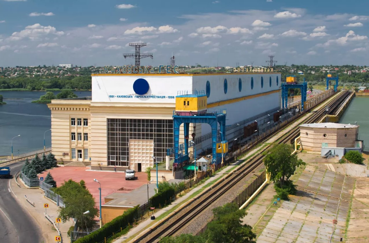
https://uhe.gov.ua/filiyi/kakhovska_hes_imeni_p_s_neporozhnoho ↗
Каховська ГЕС


Перші версії плану побудови греблі (невалідні — ГЕС з іншої сторони, інше викривлення греблі)
1943 Dnipro river state
Source: https://twitter.com/tom_bike/status/1668306000544165888/photo/1 ↗
Other photos:
http://mycity.kherson.ua/gallery/thumbnails.php?album=134 ↗
~ The End ~
Contact me: Kos Palchyk ↗